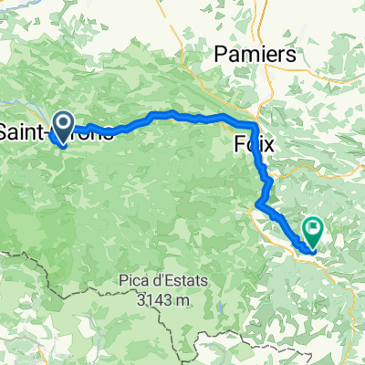
E_Pyr_Massat-35
A cycling route starting in Saint-Girons, Languedoc-Roussillon-Midi-Pyrénées, France.
Overview
About this route
Col de Péguère (1389 m) + Col du Portel (1432 m)
- -:--
- Duration
- 34.9 km
- Distance
- 1,125 m
- Ascent
- 1,128 m
- Descent
- ---
- Avg. speed
- ---
- Avg. speed
Route quality
Waytypes & surfaces along the route
Waytypes
Road
26.8 km
(77 %)
Busy road
6.5 km
(19 %)
Surfaces
Paved
24.1 km
(69 %)
Asphalt
23.8 km
(68 %)
Paved (undefined)
0.3 km
(<1 %)
Undefined
10.9 km
(31 %)
Continue with Bikemap
Use, edit, or download this cycling route
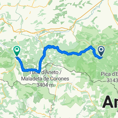
You would like to ride E_Pyr_Massat-35 or customize it for your own trip? Here is what you can do with this Bikemap route:
Free features
- Save this route as favorite or in collections
- Copy & plan your own version of this route
- Sync your route with Garmin or Wahoo
Premium features
Free trial for 3 days, or one-time payment. More about Bikemap Premium.
- Navigate this route on iOS & Android
- Export a GPX / KML file of this route
- Create your custom printout (try it for free)
- Download this route for offline navigation
Discover more Premium features.
Get Bikemap PremiumFrom our community
Other popular routes starting in Saint-Girons
- Port de l'Hers, Tarascon, Foix, col de Marrous/Portel, Biert
- Distance
- 105.5 km
- Ascent
- 1,966 m
- Descent
- 1,966 m
- Location
- Saint-Girons, Languedoc-Roussillon-Midi-Pyrénées, France
- MTB Pyrenäenrundfahrt 2 Moulis-Bagneres de Luchons
- Distance
- 75.4 km
- Ascent
- 2,268 m
- Descent
- 2,176 m
- Location
- Saint-Girons, Languedoc-Roussillon-Midi-Pyrénées, France
- Itinéraire vers Ouerdes, Eycheil
- Distance
- 29.3 km
- Ascent
- 3,110 m
- Descent
- 3,199 m
- Location
- Saint-Girons, Languedoc-Roussillon-Midi-Pyrénées, France
- 4.Etappe: Massad - Audedressin
- Distance
- 98.1 km
- Ascent
- 2,740 m
- Descent
- 2,887 m
- Location
- Saint-Girons, Languedoc-Roussillon-Midi-Pyrénées, France
- D10 Saint Girons-Ax les Termes
- Distance
- 101.6 km
- Ascent
- 1,927 m
- Descent
- 1,927 m
- Location
- Saint-Girons, Languedoc-Roussillon-Midi-Pyrénées, France
- etapa 3 - R
- Distance
- 111.4 km
- Ascent
- 2,627 m
- Descent
- 2,337 m
- Location
- Saint-Girons, Languedoc-Roussillon-Midi-Pyrénées, France
- Tour de France 2017 Stage 14
- Distance
- 96.6 km
- Ascent
- ---
- Descent
- ---
- Location
- Saint-Girons, Languedoc-Roussillon-Midi-Pyrénées, France
- Bethmale - Auzat
- Distance
- 72.5 km
- Ascent
- 2,574 m
- Descent
- 2,613 m
- Location
- Saint-Girons, Languedoc-Roussillon-Midi-Pyrénées, France