

🚴♀️E*Bike🇦🇹 5.Tag Vom Hotel Thannheimertal Radweg 29.06.18.
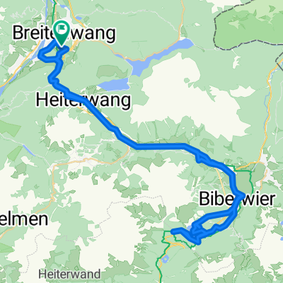
A cycling route starting in Breitenwang, Tyrol, Austria.
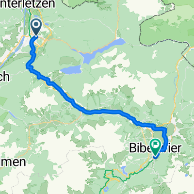
Overview
About this route
From the hotel to the start, it is 16 km and 300 meters of elevation. After the start towards Mpreis about 7 km. Bus stop Schattwald 47.513436, 10.462803
- -:--
- Duration
- 33.1 km
- Distance
- 373 m
- Ascent
- 147 m
- Descent
- ---
- Avg. speed
- ---
- Max. altitude

Route photos


Route quality
Waytypes & surfaces along the route
Waytypes
Track
14.2 km
(43 %)
Quiet road
6 km
(18 %)
Surfaces
Paved
24.5 km
(74 %)
Unpaved
4.6 km
(14 %)
Asphalt
21.2 km
(64 %)
Paved (undefined)
3.3 km
(10 %)
Route highlights
Points of interest along the route

Accommodation after 0 km
Hotel Moserhof
Point of interest after 16.3 km
Sart
Point of interest after 23.3 km
Mpreis nach 7 km
Point of interest after 33.1 km
Schattwald 47.513436, 10.462803
Continue with Bikemap
Use, edit, or download this cycling route
You would like to ride 🚴♀️E*Bike🇦🇹 5.Tag Vom Hotel Thannheimertal Radweg 29.06.18. or customize it for your own trip? Here is what you can do with this Bikemap route:
Free features
- Save this route as favorite or in collections
- Copy & plan your own version of this route
- Sync your route with Garmin or Wahoo
Premium features
Free trial for 3 days, or one-time payment. More about Bikemap Premium.
- Navigate this route on iOS & Android
- Export a GPX / KML file of this route
- Create your custom printout (try it for free)
- Download this route for offline navigation
Discover more Premium features.
Get Bikemap PremiumFrom our community
Other popular routes starting in Breitenwang
 Vogel 1
- Distance
- 95.6 km
- Ascent
- 1,342 m
- Descent
- 920 m
- Location
- Breitenwang, Tyrol, Austria
 Blindseerunde ab Reutte
- Distance
- 88.9 km
- Ascent
- 1,378 m
- Descent
- 1,378 m
- Location
- Breitenwang, Tyrol, Austria
 Um das Hochjoch
- Distance
- 21 km
- Ascent
- 596 m
- Descent
- 596 m
- Location
- Breitenwang, Tyrol, Austria
 Reute>Fernpass>zurück
- Distance
- 64.4 km
- Ascent
- 830 m
- Descent
- 830 m
- Location
- Breitenwang, Tyrol, Austria
 Dürrenberger Alm
- Distance
- 5.6 km
- Ascent
- 593 m
- Descent
- 55 m
- Location
- Breitenwang, Tyrol, Austria
 Allgäuer Seenrunde
- Distance
- 95.2 km
- Ascent
- 431 m
- Descent
- 433 m
- Location
- Breitenwang, Tyrol, Austria
 Plansee-Runde
- Distance
- 92.2 km
- Ascent
- 890 m
- Descent
- 887 m
- Location
- Breitenwang, Tyrol, Austria
 Route zu OTTOs Grillstube
- Distance
- 26.2 km
- Ascent
- 616 m
- Descent
- 447 m
- Location
- Breitenwang, Tyrol, Austria
Open it in the app