schlechtwettertour
A cycling route starting in Dalheim, District de Grevenmacher, Luxembourg.
Overview
About this route
perfekt mit mtb bei schlechtem wetter.. kein tiefer boden da 95% geteerter feldweg zwar teilweise in schlechtem zustand aber immer zu fahren
- -:--
- Duration
- 29.1 km
- Distance
- 480 m
- Ascent
- 479 m
- Descent
- ---
- Avg. speed
- 330 m
- Avg. speed
Route quality
Waytypes & surfaces along the route
Waytypes
Track
16.6 km
(57 %)
Busy road
3.9 km
(14 %)
Surfaces
Paved
22.4 km
(77 %)
Unpaved
5.6 km
(19 %)
Asphalt
14.4 km
(49 %)
Paved (undefined)
3.6 km
(13 %)
Continue with Bikemap
Use, edit, or download this cycling route
You would like to ride schlechtwettertour or customize it for your own trip? Here is what you can do with this Bikemap route:
Free features
- Save this route as favorite or in collections
- Copy & plan your own version of this route
- Sync your route with Garmin or Wahoo
Premium features
Free trial for 3 days, or one-time payment. More about Bikemap Premium.
- Navigate this route on iOS & Android
- Export a GPX / KML file of this route
- Create your custom printout (try it for free)
- Download this route for offline navigation
Discover more Premium features.
Get Bikemap PremiumFrom our community
Other popular routes starting in Dalheim
- duelem aspelt
- Distance
- 13.3 km
- Ascent
- 128 m
- Descent
- 142 m
- Location
- Dalheim, District de Grevenmacher, Luxembourg
- duelem muttwocht waldbri
- Distance
- 19.4 km
- Ascent
- 199 m
- Descent
- 197 m
- Location
- Dalheim, District de Grevenmacher, Luxembourg
- 20170516
- Distance
- 56.2 km
- Ascent
- 289 m
- Descent
- 292 m
- Location
- Dalheim, District de Grevenmacher, Luxembourg
- Kurze Ausfahrt von Dalheim nach Luxembourg
- Distance
- 11.2 km
- Ascent
- 262 m
- Descent
- 312 m
- Location
- Dalheim, District de Grevenmacher, Luxembourg
- hondsschoul 1
- Distance
- 33.2 km
- Ascent
- 399 m
- Descent
- 314 m
- Location
- Dalheim, District de Grevenmacher, Luxembourg
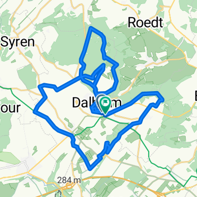
- Itinéraire confortable en Dalheim
- Distance
- 25.1 km
- Ascent
- 358 m
- Descent
- 349 m
- Location
- Dalheim, District de Grevenmacher, Luxembourg
- déi gréng - randonnée Flisdorf - Stadtbredimus
- Distance
- 40.5 km
- Ascent
- 324 m
- Descent
- 363 m
- Location
- Dalheim, District de Grevenmacher, Luxembourg
- rando Fraenk Schleck
- Distance
- 88.4 km
- Ascent
- 402 m
- Descent
- 497 m
- Location
- Dalheim, District de Grevenmacher, Luxembourg
Open it in the app