

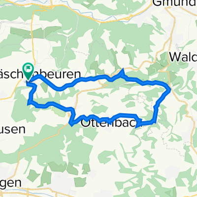
Wäschenbeuren-Hohberg
A cycling route starting in Wäschenbeuren, Baden-Wurttemberg, Germany.
Overview
About this route
- -:--
- Duration
- 42.9 km
- Distance
- 804 m
- Ascent
- 804 m
- Descent
- ---
- Avg. speed
- ---
- Max. altitude
Route quality
Waytypes & surfaces along the route
Waytypes
Track
29.6 km
(69 %)
Quiet road
9.9 km
(23 %)
Surfaces
Paved
15 km
(35 %)
Unpaved
22.7 km
(53 %)
Gravel
18.9 km
(44 %)
Asphalt
14.6 km
(34 %)
Continue with Bikemap
Use, edit, or download this cycling route
You would like to ride Wäschenbeuren-Hohberg or customize it for your own trip? Here is what you can do with this Bikemap route:
Free features
- Save this route as favorite or in collections
- Copy & plan your own version of this route
- Sync your route with Garmin or Wahoo
Premium features
Free trial for 3 days, or one-time payment. More about Bikemap Premium.
- Navigate this route on iOS & Android
- Export a GPX / KML file of this route
- Create your custom printout (try it for free)
- Download this route for offline navigation
Discover more Premium features.
Get Bikemap PremiumFrom our community
Other popular routes starting in Wäschenbeuren
 Gerade Fahrt in Göppingen
- Distance
- 2.5 km
- Ascent
- 128 m
- Descent
- 8 m
- Location
- Wäschenbeuren, Baden-Wurttemberg, Germany
 2013 Wäschenbeuren - Friedrichshafen
- Distance
- 175.4 km
- Ascent
- 970 m
- Descent
- 1,000 m
- Location
- Wäschenbeuren, Baden-Wurttemberg, Germany
 Abendrunde 22km
- Distance
- 22.8 km
- Ascent
- 462 m
- Descent
- 462 m
- Location
- Wäschenbeuren, Baden-Wurttemberg, Germany
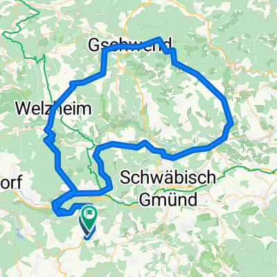
 Wäschenbeuren Ottenbach Bartenbach
- Distance
- 32.9 km
- Ascent
- 513 m
- Descent
- 513 m
- Location
- Wäschenbeuren, Baden-Wurttemberg, Germany
 Route 2
- Distance
- 90.4 km
- Ascent
- 736 m
- Descent
- 729 m
- Location
- Wäschenbeuren, Baden-Wurttemberg, Germany
 Hohenstaufen
- Distance
- 10.8 km
- Ascent
- 425 m
- Descent
- 424 m
- Location
- Wäschenbeuren, Baden-Wurttemberg, Germany
 Maitis-Faurndau-Strassdorf
- Distance
- 30.2 km
- Ascent
- 201 m
- Descent
- 208 m
- Location
- Wäschenbeuren, Baden-Wurttemberg, Germany
 Wäschenbeuren - Heubach - Ottenbach - WB
- Distance
- 73.7 km
- Ascent
- 1,336 m
- Descent
- 1,298 m
- Location
- Wäschenbeuren, Baden-Wurttemberg, Germany
Open it in the app