Dolinki podkrakowskie
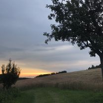
A cycling route starting in Bolechowice, Lesser Poland Voivodeship, Poland.
Overview
About this route
po zimie dość mokro i utrudnienia w postaci powalonych drzew ;)
- -:--
- Duration
- 24 km
- Distance
- 424 m
- Ascent
- 415 m
- Descent
- ---
- Avg. speed
- 450 m
- Avg. speed
Route quality
Waytypes & surfaces along the route
Waytypes
Quiet road
10.5 km
(44 %)
Road
5.7 km
(24 %)
Surfaces
Paved
15.5 km
(64 %)
Unpaved
6 km
(25 %)
Asphalt
14.7 km
(61 %)
Ground
3.7 km
(16 %)
Continue with Bikemap
Use, edit, or download this cycling route
You would like to ride Dolinki podkrakowskie or customize it for your own trip? Here is what you can do with this Bikemap route:
Free features
- Save this route as favorite or in collections
- Copy & plan your own version of this route
- Sync your route with Garmin or Wahoo
Premium features
Free trial for 3 days, or one-time payment. More about Bikemap Premium.
- Navigate this route on iOS & Android
- Export a GPX / KML file of this route
- Create your custom printout (try it for free)
- Download this route for offline navigation
Discover more Premium features.
Get Bikemap PremiumFrom our community
Other popular routes starting in Bolechowice
- Dolinki 2021 z Bolechowic
- Distance
- 35.4 km
- Ascent
- 730 m
- Descent
- 730 m
- Location
- Bolechowice, Lesser Poland Voivodeship, Poland
- Dolinki Podkrakowskie - pętla z Bolechowic (CZERWONY modyfikacja)
- Distance
- 24.3 km
- Ascent
- 486 m
- Descent
- 486 m
- Location
- Bolechowice, Lesser Poland Voivodeship, Poland
- 2017-04-24
- Distance
- 19.7 km
- Ascent
- 462 m
- Descent
- 462 m
- Location
- Bolechowice, Lesser Poland Voivodeship, Poland
- Bolechowicka Kobylanska
- Distance
- 8.6 km
- Ascent
- 258 m
- Descent
- 256 m
- Location
- Bolechowice, Lesser Poland Voivodeship, Poland
- Dolinki szybko
- Distance
- 31.7 km
- Ascent
- 489 m
- Descent
- 487 m
- Location
- Bolechowice, Lesser Poland Voivodeship, Poland
- Jura - 4 dolinki
- Distance
- 38.7 km
- Ascent
- 517 m
- Descent
- 519 m
- Location
- Bolechowice, Lesser Poland Voivodeship, Poland
- BWI MTB RIDE #3 Ojcowski Park Narodowy
- Distance
- 39.7 km
- Ascent
- 795 m
- Descent
- 798 m
- Location
- Bolechowice, Lesser Poland Voivodeship, Poland
- Dolinki podkrakowskie
- Distance
- 25.1 km
- Ascent
- 437 m
- Descent
- 437 m
- Location
- Bolechowice, Lesser Poland Voivodeship, Poland
Open it in the app