

2018 - 4/7
A cycling route starting in Feldthurns, Trentino-Alto Adige, Italy.
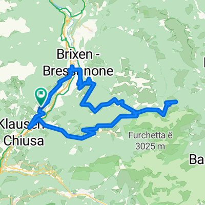
Overview
About this route
Gufidaun/Gudon
Latzfons - Rodenecker Alm - Passo di Eores
Gufidaun/Gudon
- -:--
- Duration
- 97.5 km
- Distance
- 2,866 m
- Ascent
- 2,864 m
- Descent
- ---
- Avg. speed
- ---
- Max. altitude

Route quality
Waytypes & surfaces along the route
Waytypes
Quiet road
46.8 km
(48 %)
Road
36.1 km
(37 %)
Surfaces
Paved
72.2 km
(74 %)
Asphalt
66.3 km
(68 %)
Paved (undefined)
5.9 km
(6 %)
Undefined
25.4 km
(26 %)
Continue with Bikemap
Use, edit, or download this cycling route
You would like to ride 2018 - 4/7 or customize it for your own trip? Here is what you can do with this Bikemap route:
Free features
- Save this route as favorite or in collections
- Copy & plan your own version of this route
- Split it into stages to create a multi-day tour
- Sync your route with Garmin or Wahoo
Premium features
Free trial for 3 days, or one-time payment. More about Bikemap Premium.
- Navigate this route on iOS & Android
- Export a GPX / KML file of this route
- Create your custom printout (try it for free)
- Download this route for offline navigation
Discover more Premium features.
Get Bikemap PremiumFrom our community
Other popular routes starting in Feldthurns
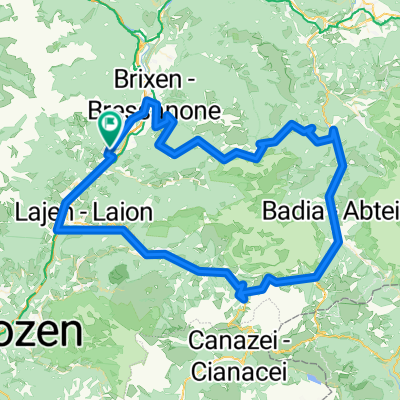
 Über Brixen zum Würzjoch - zurück über Klausen
- Distance
- 71.9 km
- Ascent
- 1,985 m
- Descent
- 1,983 m
- Location
- Feldthurns, Trentino-Alto Adige, Italy
 Alte Landstraße, Velturno to Via Brigata Acqui, Trento
- Distance
- 101.7 km
- Ascent
- 798 m
- Descent
- 1,144 m
- Location
- Feldthurns, Trentino-Alto Adige, Italy
 Würzjoch - Runde
- Distance
- 66.8 km
- Ascent
- 2,021 m
- Descent
- 2,012 m
- Location
- Feldthurns, Trentino-Alto Adige, Italy
 Sellarunde komplett
- Distance
- 128.4 km
- Ascent
- 3,205 m
- Descent
- 3,205 m
- Location
- Feldthurns, Trentino-Alto Adige, Italy
 Via Haeselbrunn nach Via Haeselbrunn
- Distance
- 38.3 km
- Ascent
- 2,358 m
- Descent
- 2,356 m
- Location
- Feldthurns, Trentino-Alto Adige, Italy
 2014 Dolomiten Gesamt IST Track
- Distance
- 226 km
- Ascent
- 6,662 m
- Descent
- 6,662 m
- Location
- Feldthurns, Trentino-Alto Adige, Italy
 Erste Etappe Dolomiti 2012
- Distance
- 124.7 km
- Ascent
- 3,030 m
- Descent
- 3,027 m
- Location
- Feldthurns, Trentino-Alto Adige, Italy
 Day6: From Klausen to Lienz
- Distance
- 132.6 km
- Ascent
- 2,268 m
- Descent
- 2,738 m
- Location
- Feldthurns, Trentino-Alto Adige, Italy
Open it in the app