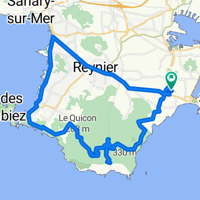

Tour de Six Fours
- 38.1 km
- 323 m
- 323 m
- La Seyne-sur-Mer, Provence-Alpes-Côte d'Azur Region, France
A cycling route starting in La Seyne-sur-Mer, Provence-Alpes-Côte d'Azur Region, France.
Overview
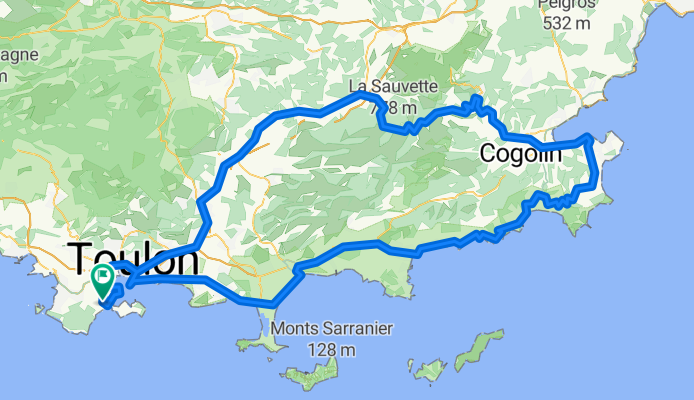
La Seyne-Sablettes - Port - Pyro - Lagoubran – Toulon - La Valette – La Farlède – Solliès-Pont – Cuers – Carnoules – Pignans – Gonfaron - Col des Fourches ( 535 m ) – R.F.12 « Route des crêtes Marc Robert » ( L’Argentière – cote 660 m – Les Cinq Cèdes – Col de la Court – Pic Martin – les Roches Blanches ) – La Garde-Freinet – Grimaud – La Foux – St-Tropez – Ste Anne – Ramatuelle ( bas ) – Col de Collebasse ( 129 m ) – La Croix-Valmer – piste – Cavalaire – Col de l’Etoile ( 123 m ) - Le Rayol – Canadel – Pramousquier – piste – Cavalière - Le Lavandou – La Londe – L’Ayguade – Les Salins – Port d’Hyères – L’Almanarre – Carqueiranne – Le Pradet – Ste Marguerite – Cap Brun – Corniche du Mourillon - Toulon – piste – Lagoubran – Pyro - Port – Corniche Tamaris - La Seyne-Sablettes.
created this 8 years ago
Route quality
Cycleway
39.5 km
19 %
Quiet road
29.1 km
14 %
Paved
162.3 km
(78 %)
Asphalt
162.3 km
78 %
Undefined
45.8 km
22 %
Continue with Bikemap
You would like to ride Crêtes "Marc Robert" - St Tropez - 21 Déc. 17 or customize it for your own trip? Here is what you can do with this Bikemap route:
Free trial for 3 days, or one-time payment. More about Bikemap Premium.
Discover more Premium features.
Get Bikemap PremiumFrom our community
Open it in the app