

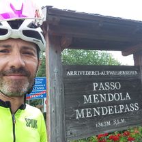
Eppan Gampen Mendel
A cycling route starting in San Michele, Trentino-Alto Adige, Italy.
Overview
About this route
- -:--
- Duration
- 69.7 km
- Distance
- 2,212 m
- Ascent
- 2,209 m
- Descent
- ---
- Avg. speed
- 1,535 m
- Max. altitude
Route quality
Waytypes & surfaces along the route
Waytypes
Road
8.4 km
(12 %)
Quiet road
6.3 km
(9 %)
Surfaces
Paved
61.3 km
(88 %)
Asphalt
61.3 km
(88 %)
Undefined
8.4 km
(12 %)
Continue with Bikemap
Use, edit, or download this cycling route
You would like to ride Eppan Gampen Mendel or customize it for your own trip? Here is what you can do with this Bikemap route:
Free features
- Save this route as favorite or in collections
- Copy & plan your own version of this route
- Sync your route with Garmin or Wahoo
Premium features
Free trial for 3 days, or one-time payment. More about Bikemap Premium.
- Navigate this route on iOS & Android
- Export a GPX / KML file of this route
- Create your custom printout (try it for free)
- Download this route for offline navigation
Discover more Premium features.
Get Bikemap PremiumFrom our community
Other popular routes starting in San Michele
 Montiggl Di1
- Distance
- 15.3 km
- Ascent
- 498 m
- Descent
- 495 m
- Location
- San Michele, Trentino-Alto Adige, Italy
 MENDELPASS/ PASSO DELLA MENDOLA + PENEGAL (por Sopra di Sotto)
- Distance
- 19.4 km
- Ascent
- 1,755 m
- Descent
- 440 m
- Location
- San Michele, Trentino-Alto Adige, Italy
 Perdoing/Gaid
- Distance
- 27.8 km
- Ascent
- 797 m
- Descent
- 797 m
- Location
- San Michele, Trentino-Alto Adige, Italy
 MTB-Tour durch den Montiggler Wald
- Distance
- 19.3 km
- Ascent
- 0 m
- Descent
- 0 m
- Location
- San Michele, Trentino-Alto Adige, Italy
 Badetour zum Montiggler See
- Distance
- 11.2 km
- Ascent
- 236 m
- Descent
- 193 m
- Location
- San Michele, Trentino-Alto Adige, Italy
 St. Michel - Trient_14_11_19
- Distance
- 58.9 km
- Ascent
- 57 m
- Descent
- 278 m
- Location
- San Michele, Trentino-Alto Adige, Italy
 Altavia di Appiano lungo
- Distance
- 19.2 km
- Ascent
- 885 m
- Descent
- 885 m
- Location
- San Michele, Trentino-Alto Adige, Italy
 Mendel-, Gampenpass, Montiggler See
- Distance
- 80.7 km
- Ascent
- 2,467 m
- Descent
- 2,417 m
- Location
- San Michele, Trentino-Alto Adige, Italy
Open it in the app