

Gelobtland-Schwarzwassertal
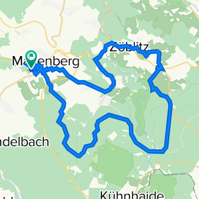
A cycling route starting in Marienberg, Saxony, Germany.
Overview
About this route
- -:--
- Duration
- 17 km
- Distance
- 433 m
- Ascent
- 430 m
- Descent
- ---
- Avg. speed
- ---
- Max. altitude
Route quality
Waytypes & surfaces along the route
Waytypes
Track
10.5 km
(62 %)
Quiet road
5 km
(30 %)
Surfaces
Paved
2.4 km
(14 %)
Unpaved
11.4 km
(67 %)
Ground
4.3 km
(25 %)
Gravel
3.7 km
(22 %)
Continue with Bikemap
Use, edit, or download this cycling route
You would like to ride Gelobtland-Schwarzwassertal or customize it for your own trip? Here is what you can do with this Bikemap route:
Free features
- Save this route as favorite or in collections
- Copy & plan your own version of this route
- Sync your route with Garmin or Wahoo
Premium features
Free trial for 3 days, or one-time payment. More about Bikemap Premium.
- Navigate this route on iOS & Android
- Export a GPX / KML file of this route
- Create your custom printout (try it for free)
- Download this route for offline navigation
Discover more Premium features.
Get Bikemap PremiumFrom our community
Other popular routes starting in Marienberg
 Gerade Fahrt in Marienberg
- Distance
- 18 km
- Ascent
- 358 m
- Descent
- 354 m
- Location
- Marienberg, Saxony, Germany
 Gemütliche Route in Marienberg
- Distance
- 8.8 km
- Ascent
- 104 m
- Descent
- 104 m
- Location
- Marienberg, Saxony, Germany
 Ansprung Cafe
- Distance
- 36.9 km
- Ascent
- 619 m
- Descent
- 624 m
- Location
- Marienberg, Saxony, Germany
 Mab-ATSV-Mab
- Distance
- 15.3 km
- Ascent
- 200 m
- Descent
- 200 m
- Location
- Marienberg, Saxony, Germany
 Lauta, Lauterbacher Knochen, Jüdenhain, Lauta Pferdegöpel
- Distance
- 10.9 km
- Ascent
- 147 m
- Descent
- 148 m
- Location
- Marienberg, Saxony, Germany
 Erzgebirge 20180519
- Distance
- 25.8 km
- Ascent
- 339 m
- Descent
- 339 m
- Location
- Marienberg, Saxony, Germany
 Drei Talsperren
- Distance
- 49.8 km
- Ascent
- 1,128 m
- Descent
- 1,127 m
- Location
- Marienberg, Saxony, Germany
 Erzgebirge 20180617
- Distance
- 38 km
- Ascent
- 507 m
- Descent
- 507 m
- Location
- Marienberg, Saxony, Germany
Open it in the app