

Сарајево - Θεσσαλονίκη
A cycling route starting in Kobilja Glava, Federation of Bosnia and Herzegovina, Bosnia and Herzegovina.
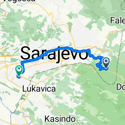
Overview
About this route
II part of the BALCAN CYCLE JOURNEY.
We start from Sarajevo destination Visegrad (the city of the bridge on the Drina river) then cross the border to Srbija down to Pljevlja (Montenegro). Through the mountain we cross the border with Kossovo to Visoki Decani. Then we proceed to Prizren and from there to Ohrid. Final destination Thessaloniki.
- -:--
- Duration
- 914.1 km
- Distance
- 6,076 m
- Ascent
- 6,593 m
- Descent
- ---
- Avg. speed
- ---
- Max. altitude

Route quality
Waytypes & surfaces along the route
Waytypes
Quiet road
210.2 km
(23 %)
Road
109.7 km
(12 %)
Surfaces
Paved
447.9 km
(49 %)
Unpaved
73.1 km
(8 %)
Asphalt
429.6 km
(47 %)
Gravel
54.8 km
(6 %)
Route highlights
Points of interest along the route

Point of interest after 117.9 km
Visegrad - Il ponte sulla Drina

Point of interest after 197.4 km
Holy Trinity Monastery - Pljevlja

Point of interest after 398.7 km
Манастир Високи Дечани - Monastero Visoki Decani

Point of interest after 458.5 km
Prizren

Point of interest after 650.3 km
Lake Ohrid
Continue with Bikemap
Use, edit, or download this cycling route
You would like to ride Сарајево - Θεσσαλονίκη or customize it for your own trip? Here is what you can do with this Bikemap route:
Free features
- Save this route as favorite or in collections
- Copy & plan your own version of this route
- Split it into stages to create a multi-day tour
- Sync your route with Garmin or Wahoo
Premium features
Free trial for 3 days, or one-time payment. More about Bikemap Premium.
- Navigate this route on iOS & Android
- Export a GPX / KML file of this route
- Create your custom printout (try it for free)
- Download this route for offline navigation
Discover more Premium features.
Get Bikemap PremiumFrom our community
Other popular routes starting in Kobilja Glava
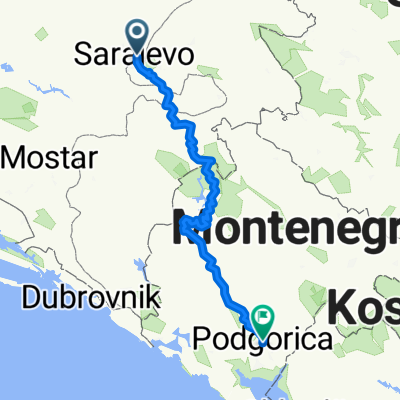 TE Sarajevo - Podgorica
- Distance
- 333.7 km
- Ascent
- 11,741 m
- Descent
- 12,236 m
- Location
- Kobilja Glava, Federation of Bosnia and Herzegovina, Bosnia and Herzegovina
 Sarajevo naar lavina hotel racefiets
- Distance
- 31.3 km
- Ascent
- 1,901 m
- Descent
- 809 m
- Location
- Kobilja Glava, Federation of Bosnia and Herzegovina, Bosnia and Herzegovina
 Asphalt_01: Dariva - Vrelo Bosne
- Distance
- 25 km
- Ascent
- 286 m
- Descent
- 317 m
- Location
- Kobilja Glava, Federation of Bosnia and Herzegovina, Bosnia and Herzegovina
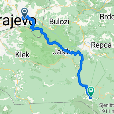
 Ruta Smrti
- Distance
- 26.4 km
- Ascent
- 960 m
- Descent
- 1,062 m
- Location
- Kobilja Glava, Federation of Bosnia and Herzegovina, Bosnia and Herzegovina
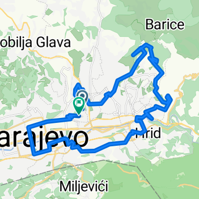 Odobašina, Sarajevo to Odobašina, Sarajevo
- Distance
- 23.2 km
- Ascent
- 865 m
- Descent
- 869 m
- Location
- Kobilja Glava, Federation of Bosnia and Herzegovina, Bosnia and Herzegovina
 Odobašina, Sarajevo to Odobašina, Sarajevo
- Distance
- 14.9 km
- Ascent
- 356 m
- Descent
- 360 m
- Location
- Kobilja Glava, Federation of Bosnia and Herzegovina, Bosnia and Herzegovina
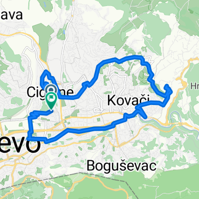
 Stari Grad Sarajevo, Sarajevo to Sulejmana Filipovića, Sarajevo
- Distance
- 14.8 km
- Ascent
- 105 m
- Descent
- 738 m
- Location
- Kobilja Glava, Federation of Bosnia and Herzegovina, Bosnia and Herzegovina
 Сарајево - Θεσσαλονίκη
- Distance
- 914.1 km
- Ascent
- 6,076 m
- Descent
- 6,593 m
- Location
- Kobilja Glava, Federation of Bosnia and Herzegovina, Bosnia and Herzegovina
Open it in the app