10. Tag Trebinj Slano
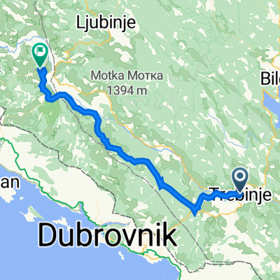
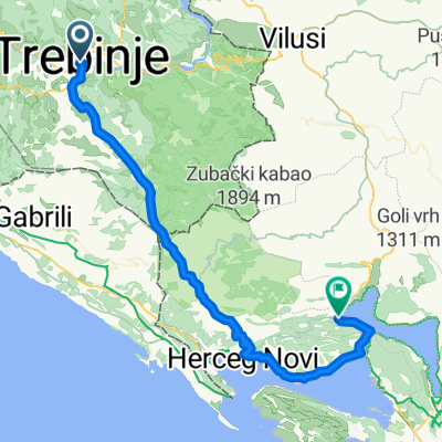
A cycling route starting in Trebinje, Republika Srpska, Bosnia and Herzegovina.
Overview
About this route
- -:--
- Duration
- 70.9 km
- Distance
- 667 m
- Ascent
- 916 m
- Descent
- ---
- Avg. speed
- ---
- Avg. speed
Route quality
Waytypes & surfaces along the route
Waytypes
Busy road
55.3 km
(78 %)
Quiet road
7 km
(10 %)
Surfaces
Paved
63.6 km
(90 %)
Unpaved
0.6 km
(<1 %)
Asphalt
60.7 km
(86 %)
Paved (undefined)
2.9 km
(4 %)
Continue with Bikemap
Use, edit, or download this cycling route
You would like to ride 10. Tag Trebinj Slano or customize it for your own trip? Here is what you can do with this Bikemap route:
Free features
- Save this route as favorite or in collections
- Copy & plan your own version of this route
- Sync your route with Garmin or Wahoo
Premium features
Free trial for 3 days, or one-time payment. More about Bikemap Premium.
- Navigate this route on iOS & Android
- Export a GPX / KML file of this route
- Create your custom printout (try it for free)
- Download this route for offline navigation
Discover more Premium features.
Get Bikemap PremiumFrom our community
Other popular routes starting in Trebinje
- Vrh Leotara
- Distance
- 13.2 km
- Ascent
- 1,110 m
- Descent
- 185 m
- Location
- Trebinje, Republika Srpska, Bosnia and Herzegovina
- gggggggggggggggggggggg
- Distance
- 88.4 km
- Ascent
- 811 m
- Descent
- 1,088 m
- Location
- Trebinje, Republika Srpska, Bosnia and Herzegovina
- 10. Tag Trebinj Slano
- Distance
- 70.9 km
- Ascent
- 667 m
- Descent
- 916 m
- Location
- Trebinje, Republika Srpska, Bosnia and Herzegovina
- Slow ride
- Distance
- 2.3 km
- Ascent
- 0 m
- Descent
- 41 m
- Location
- Trebinje, Republika Srpska, Bosnia and Herzegovina
- BikeProject2019 - Montenegro Albania
- Distance
- 894.1 km
- Ascent
- 5,109 m
- Descent
- 5,169 m
- Location
- Trebinje, Republika Srpska, Bosnia and Herzegovina
- Tour 2018 Tag 10
- Distance
- 71.2 km
- Ascent
- 706 m
- Descent
- 977 m
- Location
- Trebinje, Republika Srpska, Bosnia and Herzegovina
- Trebinje - Meljine kružni tok
- Distance
- 41.6 km
- Ascent
- 652 m
- Descent
- 923 m
- Location
- Trebinje, Republika Srpska, Bosnia and Herzegovina
- Zasad polje, Trebinje to Unnamed Road
- Distance
- 6 km
- Ascent
- 34 m
- Descent
- 38 m
- Location
- Trebinje, Republika Srpska, Bosnia and Herzegovina
Open it in the app