

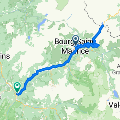
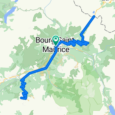
Petit St. Bernard, Aosta
A cycling route starting in Bourg-Saint-Maurice, Auvergne-Rhône-Alpes, France.
Overview
About this route
- -:--
- Duration
- 114.6 km
- Distance
- 3,024 m
- Ascent
- 3,026 m
- Descent
- ---
- Avg. speed
- ---
- Max. altitude

Route quality
Waytypes & surfaces along the route
Waytypes
Road
18.3 km
(16 %)
Quiet road
4.6 km
(4 %)
Surfaces
Paved
85.9 km
(75 %)
Unpaved
2.3 km
(2 %)
Asphalt
85.9 km
(75 %)
Unpaved (undefined)
1.1 km
(1 %)
Continue with Bikemap
Use, edit, or download this cycling route
You would like to ride Petit St. Bernard, Aosta or customize it for your own trip? Here is what you can do with this Bikemap route:
Free features
- Save this route as favorite or in collections
- Copy & plan your own version of this route
- Split it into stages to create a multi-day tour
- Sync your route with Garmin or Wahoo
Premium features
Free trial for 3 days, or one-time payment. More about Bikemap Premium.
- Navigate this route on iOS & Android
- Export a GPX / KML file of this route
- Create your custom printout (try it for free)
- Download this route for offline navigation
Discover more Premium features.
Get Bikemap PremiumFrom our community
Other popular routes starting in Bourg-Saint-Maurice
 COL DU PETIT SAINT-BERNARD (por Bourg Saint-Maurice)
- Distance
- 94.5 km
- Ascent
- 1,987 m
- Descent
- 2,319 m
- Location
- Bourg-Saint-Maurice, Auvergne-Rhône-Alpes, France
 2017 ALPS Col de l'Iseran a
- Distance
- 147.7 km
- Ascent
- 3,138 m
- Descent
- 3,138 m
- Location
- Bourg-Saint-Maurice, Auvergne-Rhône-Alpes, France
 Cormet de Roselend
- Distance
- 84.3 km
- Ascent
- 3,144 m
- Descent
- 3,145 m
- Location
- Bourg-Saint-Maurice, Auvergne-Rhône-Alpes, France
 2017 ALPS Etapa 2 - La plagne
- Distance
- 120 km
- Ascent
- 2,737 m
- Descent
- 2,737 m
- Location
- Bourg-Saint-Maurice, Auvergne-Rhône-Alpes, France
 Francia Alpok 03 vándor
- Distance
- 97.4 km
- Ascent
- 2,310 m
- Descent
- 1,645 m
- Location
- Bourg-Saint-Maurice, Auvergne-Rhône-Alpes, France
 Petit St. Bernard, Aosta
- Distance
- 114.6 km
- Ascent
- 3,024 m
- Descent
- 3,026 m
- Location
- Bourg-Saint-Maurice, Auvergne-Rhône-Alpes, France
 2017 ALPS Etapa 4 - Cormet de Roselend
- Distance
- 93.2 km
- Ascent
- 2,244 m
- Descent
- 2,519 m
- Location
- Bourg-Saint-Maurice, Auvergne-Rhône-Alpes, France
 Seéz - Col de l´Iseran - Seéz
- Distance
- 52.5 km
- Ascent
- 2,010 m
- Descent
- 342 m
- Location
- Bourg-Saint-Maurice, Auvergne-Rhône-Alpes, France
Open it in the app