

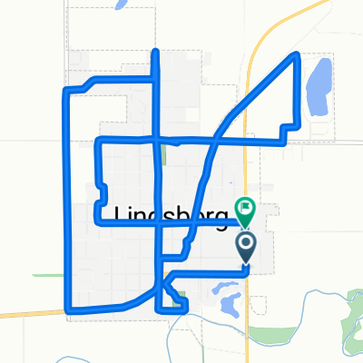
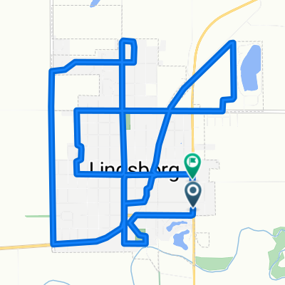
Falun Classic - Lindsborg to Falun Loop
A cycling route starting in Lindsborg, Kansas, United States.
Overview
About this route
Cycle the route of the Falun Classic, an annual October ride that meanders through the beautiful Smoky Valley. An easy, part paved, part unpaved, ride for all levels of cyclists. 32 miles of hilly paved roads, view the fall foliage, enjoy riding with friends old and new, complete with sag stops and lunch after in Swenssen Park. Register for this ride at www.bikereg.com .
- -:--
- Duration
- 49.1 km
- Distance
- 135 m
- Ascent
- 133 m
- Descent
- ---
- Avg. speed
- ---
- Max. altitude

Route photos


Route quality
Waytypes & surfaces along the route
Waytypes
Road
31.9 km
(65 %)
Quiet road
9.8 km
(20 %)
Undefined
7.4 km
(15 %)
Surfaces
Paved
6.9 km
(14 %)
Asphalt
6.9 km
(14 %)
Undefined
42.2 km
(86 %)
Continue with Bikemap
Use, edit, or download this cycling route
You would like to ride Falun Classic - Lindsborg to Falun Loop or customize it for your own trip? Here is what you can do with this Bikemap route:
Free features
- Save this route as favorite or in collections
- Copy & plan your own version of this route
- Sync your route with Garmin or Wahoo
Premium features
Free trial for 3 days, or one-time payment. More about Bikemap Premium.
- Navigate this route on iOS & Android
- Export a GPX / KML file of this route
- Create your custom printout (try it for free)
- Download this route for offline navigation
Discover more Premium features.
Get Bikemap PremiumFrom our community
Other popular routes starting in Lindsborg
 Lindsborg to Maxwell Wildlife Refuge
- Distance
- 70.8 km
- Ascent
- 298 m
- Descent
- 300 m
- Location
- Lindsborg, Kansas, United States
 Falun Classic - Lindsborg to Falun Loop
- Distance
- 49.1 km
- Ascent
- 135 m
- Descent
- 133 m
- Location
- Lindsborg, Kansas, United States
 Cole1
Cole1- Distance
- 16.1 km
- Ascent
- 83 m
- Descent
- 62 m
- Location
- Lindsborg, Kansas, United States
 Lindsborg/Roxbury/Gypsum Loop
- Distance
- 76.2 km
- Ascent
- 198 m
- Descent
- 200 m
- Location
- Lindsborg, Kansas, United States
 708 Emerald Dr, Lindsborg to Bethany Dr, Lindsborg
- Distance
- 22.6 km
- Ascent
- 154 m
- Descent
- 152 m
- Location
- Lindsborg, Kansas, United States
 South Cole Street to South Cole Street
- Distance
- 16 km
- Ascent
- 81 m
- Descent
- 56 m
- Location
- Lindsborg, Kansas, United States
 Välkommen Trail - Lindsborg
- Distance
- 5 km
- Ascent
- 11 m
- Descent
- 9 m
- Location
- Lindsborg, Kansas, United States
 Lindsborg to Coronado Heights
- Distance
- 14.7 km
- Ascent
- 106 m
- Descent
- 106 m
- Location
- Lindsborg, Kansas, United States
Open it in the app