

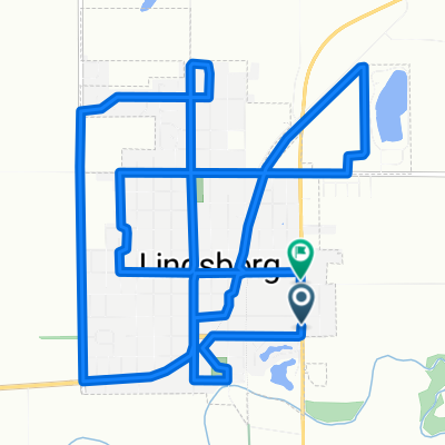
Lindsborg via the Meadowlark Trail to Marquette
A cycling route starting in Lindsborg, Kansas, United States.
Overview
About this route
This low traffic cycle route is a great way to unwind and leave all your cares behind you. Be certain to ignore the Higway miles of this route; take the Meadowlark Trail (the trailhead begins at the south end Lindsborg's Valkommen Trail, a paved 2.3 mile pedestrian and cycling path through Lindsborg) to Shawnee Road, then head west to Marquette. This entire route is paved, with the exception of the well maintained three mile section of the Meadowlark Trail which is compacted shale.
Leave Lindsborg early and stop in Marquette at the cafe for breakfast or Piper's Fine Foods for a fresh bottle of water and the snack of your choice.
If you want new scenery, you can also head back to Lindsborg via Highway 4 in time for lunch! Lindsborg has a variety of great stops for fresh food.
- -:--
- Duration
- 49 km
- Distance
- 86 m
- Ascent
- 89 m
- Descent
- ---
- Avg. speed
- ---
- Max. altitude

Route photos


Route quality
Waytypes & surfaces along the route
Waytypes
Road
41.7 km
(85 %)
Quiet road
4.4 km
(9 %)
Surfaces
Paved
15.7 km
(32 %)
Asphalt
15.7 km
(32 %)
Undefined
33.3 km
(68 %)
Continue with Bikemap
Use, edit, or download this cycling route
You would like to ride Lindsborg via the Meadowlark Trail to Marquette or customize it for your own trip? Here is what you can do with this Bikemap route:
Free features
- Save this route as favorite or in collections
- Copy & plan your own version of this route
- Sync your route with Garmin or Wahoo
Premium features
Free trial for 3 days, or one-time payment. More about Bikemap Premium.
- Navigate this route on iOS & Android
- Export a GPX / KML file of this route
- Create your custom printout (try it for free)
- Download this route for offline navigation
Discover more Premium features.
Get Bikemap PremiumFrom our community
Other popular routes starting in Lindsborg
 708 Emerald Dr, Lindsborg to Bethany Dr, Lindsborg
- Distance
- 22.6 km
- Ascent
- 154 m
- Descent
- 152 m
- Location
- Lindsborg, Kansas, United States
 Lindsborg/Roxbury/Gypsum Loop
- Distance
- 76.2 km
- Ascent
- 198 m
- Descent
- 200 m
- Location
- Lindsborg, Kansas, United States
 Lindsborg via the Meadowlark Trail to Marquette
- Distance
- 49 km
- Ascent
- 86 m
- Descent
- 89 m
- Location
- Lindsborg, Kansas, United States
 Lindsborg to Coronado Heights
- Distance
- 14.7 km
- Ascent
- 106 m
- Descent
- 106 m
- Location
- Lindsborg, Kansas, United States
 Välkommen Trail - Lindsborg
- Distance
- 5 km
- Ascent
- 11 m
- Descent
- 9 m
- Location
- Lindsborg, Kansas, United States
 Falun Classic - Lindsborg to Falun Loop
- Distance
- 49.1 km
- Ascent
- 135 m
- Descent
- 133 m
- Location
- Lindsborg, Kansas, United States
 Lindsborg to Maxwell Wildlife Refuge
- Distance
- 70.8 km
- Ascent
- 298 m
- Descent
- 300 m
- Location
- Lindsborg, Kansas, United States
 South Cole Street to South Cole Street
- Distance
- 16 km
- Ascent
- 81 m
- Descent
- 56 m
- Location
- Lindsborg, Kansas, United States
Open it in the app