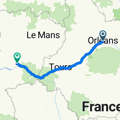
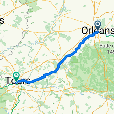
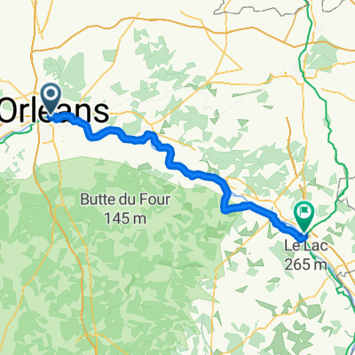
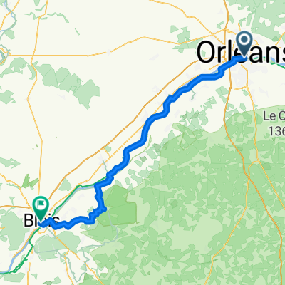
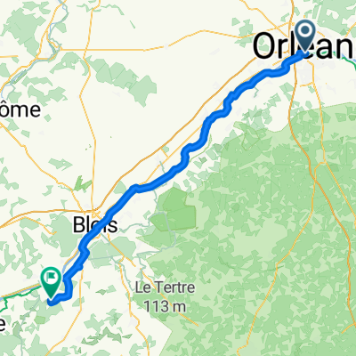
Road trip 2018
A cycling route starting in Orléans, Centre Region, France.
Overview
About this route
-OrlĂ©ans ->Saint-brĂ©vins (La loire Ă vĂ©los)Â
-Saint-brévins -> Pamplona (Eurovélo 1)
-Pamplona -> Santiago de Compostela (Eurovélo 3)
- Santiago de Compostela -> Viana do castelo (portugal) -> Faro (eurovélos 1)
- -:--
- Duration
- 5,912.9 km
- Distance
- 2,924 m
- Ascent
- 2,935 m
- Descent
- ---
- Avg. speed
- ---
- Avg. speed
Route quality
Waytypes & surfaces along the route
Waytypes
Undefined
5,912.9 km
(100 %)
Surfaces
Undefined
5,912.9 km
(100 %)
Route highlights
Points of interest along the route
Photo after 31.7 km
Village remarquable: Beaugency
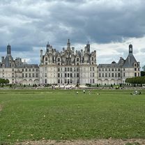
Photo after 50.8 km
Chateau de chambord
Accommodation after 68 km
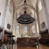
Chateau de blois + nuit
Photo after 91.9 km
Domaine de Chaumont-sur-Loire
Photo after 109.1 km
Chateau de chenonceaux
Photo after 114.8 km
Chateau et ville
Accommodation after 144.4 km
Photo after 165.8 km
Château et Jardins de Villandry
Photo after 172.1 km
Château d'Azay-le-Rideau
Photo after 176.5 km
Château de Langeais
Photo after 199.7 km
Château de Chinon
Photo after 214.8 km
Château de Montsoreau
Accommodation after 218.5 km
Village remarquable (maison dans falaise)
Photo after 229.4 km
Chateau de saumur
Photo after 274.1 km
Château de Brissac
Accommodation after 286.6 km
chateau, visite
Photo after 314.1 km
Château de Serrant
Photo after 371.2 km
Chateau d'oudon
Accommodation after 399.5 km
Accommodation after 545 km
Sleep
Accommodation after 629.8 km
sleep
Accommodation after 685 km
sleep
Accommodation after 829.4 km
airbnb
Accommodation after 906.5 km
sleep
Point of interest after 5,878.3 km
Oratoire Carolingien
Point of interest after 5,882.8 km
Parc naturel départemental de Châteauneuf-sur-Loire
Continue with Bikemap
Use, edit, or download this cycling route
You would like to ride Road trip 2018 or customize it for your own trip? Here is what you can do with this Bikemap route:
Free features
- Save this route as favorite or in collections
- Copy & plan your own version of this route
- Sync your route with Garmin or Wahoo
Premium features
Free trial for 3 days, or one-time payment. More about Bikemap Premium.
- Navigate this route on iOS & Android
- Export a GPX / KML file of this route
- Create your custom printout (try it for free)
- Download this route for offline navigation
Discover more Premium features.
Get Bikemap PremiumFrom our community
Other popular routes starting in Orléans
- De Rue de Lahire 15, Orléans à Place de la Gare 15, Châteauroux
- Distance
- 144.9 km
- Ascent
- 649 m
- Descent
- 610 m
- Location
- Orléans, Centre Region, France
- 20200728 Day 12b - Orléans à Baule
- Distance
- 24.3 km
- Ascent
- 238 m
- Descent
- 244 m
- Location
- Orléans, Centre Region, France
- Road trip 2018 (Loire, Garonne, Rhone, Rhin, Loire)
- Distance
- 3,553.9 km
- Ascent
- 2,603 m
- Descent
- 2,605 m
- Location
- Orléans, Centre Region, France
- Orléans centre > La Source
- Distance
- 7.9 km
- Ascent
- 30 m
- Descent
- 23 m
- Location
- Orléans, Centre Region, France
- La Vallée de la Loire
- Distance
- 260.3 km
- Ascent
- 1,033 m
- Descent
- 1,091 m
- Location
- Orléans, Centre Region, France
- Tour de Loire, 2010
- Distance
- 443 km
- Ascent
- 251 m
- Descent
- 357 m
- Location
- Orléans, Centre Region, France
- Itinéraire à partir de Quai du Châtelet, Orléans
- Distance
- 9.7 km
- Ascent
- 139 m
- Descent
- 144 m
- Location
- Orléans, Centre Region, France
- Road trip 2018
- Distance
- 5,912.9 km
- Ascent
- 2,924 m
- Descent
- 2,935 m
- Location
- Orléans, Centre Region, France