

Onion River Racing National Life Training Criterium
A cycling route starting in Montpelier, Vermont, United States.
Overview
About this route
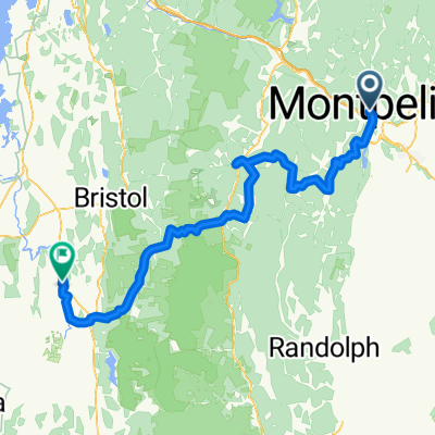
The 0.9-mile circuit around National Life Group’s headquarters consists of a 300 meter long downhill followed by a hard right hand corner, a winding 350 meter uphill section in two steps, and a flat section through the upper parking lot to the start/finish on a flat straightaway near the main entrance.
For more information about this event and how you can participate visit www.onionriverracing.com
- -:--
- Duration
- 1.3 km
- Distance
- 29 m
- Ascent
- 27 m
- Descent
- ---
- Avg. speed
- 231 m
- Max. altitude
Route quality
Waytypes & surfaces along the route
Waytypes
Access road
1 km
(73 %)
Quiet road
0.4 km
(27 %)
Surfaces
Paved
1.2 km
(92 %)
Asphalt
1.2 km
(92 %)
Undefined
0.1 km
(8 %)
Continue with Bikemap
Use, edit, or download this cycling route
You would like to ride Onion River Racing National Life Training Criterium or customize it for your own trip? Here is what you can do with this Bikemap route:
Free features
- Save this route as favorite or in collections
- Copy & plan your own version of this route
- Sync your route with Garmin or Wahoo
Premium features
Free trial for 3 days, or one-time payment. More about Bikemap Premium.
- Navigate this route on iOS & Android
- Export a GPX / KML file of this route
- Create your custom printout (try it for free)
- Download this route for offline navigation
Discover more Premium features.
Get Bikemap PremiumFrom our community
Other popular routes starting in Montpelier
 Bikepacking-Route-Green_Mountain_Gravel_Growler_v2
- Distance
- 103.2 km
- Ascent
- 2,420 m
- Descent
- 2,477 m
- Location
- Montpelier, Vermont, United States
 Home to Work
- Distance
- 18.6 km
- Ascent
- 190 m
- Descent
- 408 m
- Location
- Montpelier, Vermont, United States
 Montpellier, VT - Equinox Mountain, VT
- Distance
- 169.8 km
- Ascent
- 2,072 m
- Descent
- 1,196 m
- Location
- Montpelier, Vermont, United States
 Onion River Racing National Life Training Criterium
- Distance
- 1.3 km
- Ascent
- 29 m
- Descent
- 27 m
- Location
- Montpelier, Vermont, United States
 D3 Mtn Barre to Jeffersonville
- Distance
- 76.1 km
- Ascent
- 620 m
- Descent
- 633 m
- Location
- Montpelier, Vermont, United States
 David to Turtlehead Pond
- Distance
- 21.2 km
- Ascent
- 566 m
- Descent
- 574 m
- Location
- Montpelier, Vermont, United States
 Montpelier circulator
- Distance
- 11.8 km
- Ascent
- 83 m
- Descent
- 87 m
- Location
- Montpelier, Vermont, United States
 vermont stowe
- Distance
- 120.5 km
- Ascent
- 1,026 m
- Descent
- 806 m
- Location
- Montpelier, Vermont, United States
Open it in the app