

Irigny - Grigny
A cycling route starting in Irigny, Auvergne-Rhône-Alpes, France.
Overview
About this route
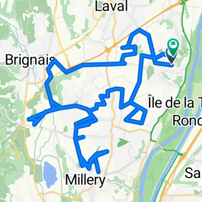
boucle 1ère partie au pied du coteau, retour par le haut du coteau.
- -:--
- Duration
- 22 km
- Distance
- 311 m
- Ascent
- 306 m
- Descent
- ---
- Avg. speed
- ---
- Max. altitude
Route quality
Waytypes & surfaces along the route
Waytypes
Busy road
8.7 km
(40 %)
Quiet road
7.8 km
(36 %)
Surfaces
Paved
11.2 km
(51 %)
Asphalt
11.2 km
(51 %)
Undefined
10.8 km
(49 %)
Continue with Bikemap
Use, edit, or download this cycling route
You would like to ride Irigny - Grigny or customize it for your own trip? Here is what you can do with this Bikemap route:
Free features
- Save this route as favorite or in collections
- Copy & plan your own version of this route
- Sync your route with Garmin or Wahoo
Premium features
Free trial for 3 days, or one-time payment. More about Bikemap Premium.
- Navigate this route on iOS & Android
- Export a GPX / KML file of this route
- Create your custom printout (try it for free)
- Download this route for offline navigation
Discover more Premium features.
Get Bikemap PremiumFrom our community
Other popular routes starting in Irigny
 boucle ternay luzinay chaponay
- Distance
- 47.1 km
- Ascent
- 339 m
- Descent
- 335 m
- Location
- Irigny, Auvergne-Rhône-Alpes, France
 pamplona-lyon
- Distance
- 1,001.8 km
- Ascent
- 1,780 m
- Descent
- 1,604 m
- Location
- Irigny, Auvergne-Rhône-Alpes, France
 Rue du Vieux Port, Irigny nach Loire-sur-Rhône
- Distance
- 18.1 km
- Ascent
- 159 m
- Descent
- 168 m
- Location
- Irigny, Auvergne-Rhône-Alpes, France
 De 3 Côte Carmagnac, Irigny à 59 Rue du Général Degoutte, Miribel
- Distance
- 27.2 km
- Ascent
- 107 m
- Descent
- 147 m
- Location
- Irigny, Auvergne-Rhône-Alpes, France
 pamplona-lyon
- Distance
- 1,001.8 km
- Ascent
- 1,823 m
- Descent
- 1,629 m
- Location
- Irigny, Auvergne-Rhône-Alpes, France
 De Rue du 8 Mai 1945 11, Irigny à Rue du 8 Mai 1945 9, Irigny
- Distance
- 13.1 km
- Ascent
- 115 m
- Descent
- 158 m
- Location
- Irigny, Auvergne-Rhône-Alpes, France
 orlienas taluyers
- Distance
- 29.5 km
- Ascent
- 368 m
- Descent
- 364 m
- Location
- Irigny, Auvergne-Rhône-Alpes, France
 De Rue du Mai à Rue du Mai
- Distance
- 37.1 km
- Ascent
- 331 m
- Descent
- 378 m
- Location
- Irigny, Auvergne-Rhône-Alpes, France
Open it in the app