

Koniec Świata
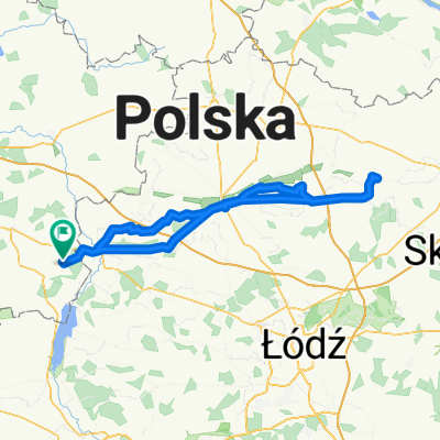
A cycling route starting in Dobra, Greater Poland Voivodeship, Poland.
Overview
About this route
- -:--
- Duration
- 123.3 km
- Distance
- 141 m
- Ascent
- 141 m
- Descent
- ---
- Avg. speed
- ---
- Max. altitude

Route quality
Waytypes & surfaces along the route
Waytypes
Road
70.3 km
(57 %)
Quiet road
25.9 km
(21 %)
Surfaces
Paved
82.6 km
(67 %)
Unpaved
3.7 km
(3 %)
Asphalt
78.9 km
(64 %)
Paved (undefined)
3.7 km
(3 %)
Continue with Bikemap
Use, edit, or download this cycling route
You would like to ride Koniec Świata or customize it for your own trip? Here is what you can do with this Bikemap route:
Free features
- Save this route as favorite or in collections
- Copy & plan your own version of this route
- Split it into stages to create a multi-day tour
- Sync your route with Garmin or Wahoo
Premium features
Free trial for 3 days, or one-time payment. More about Bikemap Premium.
- Navigate this route on iOS & Android
- Export a GPX / KML file of this route
- Create your custom printout (try it for free)
- Download this route for offline navigation
Discover more Premium features.
Get Bikemap PremiumFrom our community
Other popular routes starting in Dobra
 Boleszczyn-Koło-Chełmno-Dąbie-Uniejów
- Distance
- 92.6 km
- Ascent
- 118 m
- Descent
- 115 m
- Location
- Dobra, Greater Poland Voivodeship, Poland
 Gdańsk
- Distance
- 315.7 km
- Ascent
- 203 m
- Descent
- 318 m
- Location
- Dobra, Greater Poland Voivodeship, Poland
 Boleszczyn-Wartkowice-Poddębice-J.Jeziorsko
- Distance
- 77.7 km
- Ascent
- 164 m
- Descent
- 164 m
- Location
- Dobra, Greater Poland Voivodeship, Poland
 Sobota :)
- Distance
- 171.9 km
- Ascent
- 116 m
- Descent
- 118 m
- Location
- Dobra, Greater Poland Voivodeship, Poland
 Boleszczyn - Radyczyny-Uniejów- Zapora
- Distance
- 50 km
- Ascent
- 82 m
- Descent
- 84 m
- Location
- Dobra, Greater Poland Voivodeship, Poland
 Z Mateuszem
- Distance
- 45.3 km
- Ascent
- 68 m
- Descent
- 70 m
- Location
- Dobra, Greater Poland Voivodeship, Poland
 Bleszczyn-Gajówka-Zbiornik Przykona
- Distance
- 30.9 km
- Ascent
- 56 m
- Descent
- 55 m
- Location
- Dobra, Greater Poland Voivodeship, Poland
 Boleszczyn - Zbiornik Przykona
- Distance
- 21.8 km
- Ascent
- 39 m
- Descent
- 40 m
- Location
- Dobra, Greater Poland Voivodeship, Poland
Open it in the app