

Gws sore
A cycling route starting in Sangatta, East Kalimantan, Indonesia.
Overview
About this route
- 1 h 26 min
- Duration
- 23.1 km
- Distance
- 362 m
- Ascent
- 364 m
- Descent
- 16.1 km/h
- Avg. speed
- ---
- Max. altitude

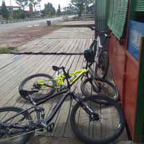
Route photos

Continue with Bikemap
Use, edit, or download this cycling route
You would like to ride Gws sore or customize it for your own trip? Here is what you can do with this Bikemap route:
Free features
- Save this route as favorite or in collections
- Copy & plan your own version of this route
- Sync your route with Garmin or Wahoo
Premium features
Free trial for 3 days, or one-time payment. More about Bikemap Premium.
- Navigate this route on iOS & Android
- Export a GPX / KML file of this route
- Create your custom printout (try it for free)
- Download this route for offline navigation
Discover more Premium features.
Get Bikemap PremiumFrom our community
Other popular routes starting in Sangatta
 bukit pelangi
- Distance
- 28.3 km
- Ascent
- 784 m
- Descent
- 812 m
- Location
- Sangatta, East Kalimantan, Indonesia
 Gang Mandiri. I 199, Sangatta Utara to Sangatta Utara
- Distance
- 14.4 km
- Ascent
- 107 m
- Descent
- 104 m
- Location
- Sangatta, East Kalimantan, Indonesia
 to day 14des21
- Distance
- 11.2 km
- Ascent
- 12 m
- Descent
- 3 m
- Location
- Sangatta, East Kalimantan, Indonesia
 Gang Rejeki 19a, Sangatta Utara to Jalan A Wahab Syaharanie 99, Sangatta Utara
- Distance
- 20.8 km
- Ascent
- 177 m
- Descent
- 187 m
- Location
- Sangatta, East Kalimantan, Indonesia
 Gws sore
- Distance
- 23.1 km
- Ascent
- 362 m
- Descent
- 364 m
- Location
- Sangatta, East Kalimantan, Indonesia
 Roda Pedal
- Distance
- 21.4 km
- Ascent
- 77 m
- Descent
- 134 m
- Location
- Sangatta, East Kalimantan, Indonesia
 bukit pelangi
- Distance
- 24.3 km
- Ascent
- 483 m
- Descent
- 567 m
- Location
- Sangatta, East Kalimantan, Indonesia
 gg.ampera-yosuda-kabo-TBA
- Distance
- 27.7 km
- Ascent
- 230 m
- Descent
- 230 m
- Location
- Sangatta, East Kalimantan, Indonesia
Open it in the app