Berliner Mauerweg
Berliner Mauerweg Teil 1: Vom Hauptbahnhof bis zum Wannsee
A cycling route starting in Tiergarten, State of Berlin, Germany.
Overview
About this route
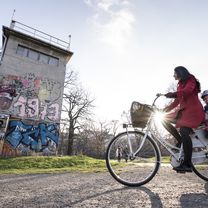
Start of the first part of the tour is the new center of the capital: With a view of the Federal Chancellery and the Reichstag, we begin on the historic route. Right at the beginning, several stops for sightseeing are offered: Just behind the Brandenburg Gate, you can ascend in a hot air balloon and view Berlin from 150 meters high (www.air-service-berlin.de/weltballon). Afterwards, we pass by Checkpoint Charlie to the East Side Gallery with its famous outdoor paintings. The tour continues into the greenery and ends with a picturesque view over the Wannsee.
- -:--
- Duration
- 82.1 km
- Distance
- 160 m
- Ascent
- 145 m
- Descent
- ---
- Avg. speed
- ---
- Max. altitude
Part of
Berliner Mauerweg
2 stages
Route photos
Route quality
Waytypes & surfaces along the route
Waytypes
Path
37.8 km
(46 %)
Quiet road
14.8 km
(18 %)
Surfaces
Paved
64.9 km
(79 %)
Unpaved
9 km
(11 %)
Asphalt
61.6 km
(75 %)
Loose gravel
4.1 km
(5 %)
Continue with Bikemap
Use, edit, or download this cycling route
You would like to ride Berliner Mauerweg Teil 1: Vom Hauptbahnhof bis zum Wannsee or customize it for your own trip? Here is what you can do with this Bikemap route:
Free features
- Save this route as favorite or in collections
- Copy & plan your own version of this route
- Split it into stages to create a multi-day tour
- Sync your route with Garmin or Wahoo
Premium features
Free trial for 3 days, or one-time payment. More about Bikemap Premium.
- Navigate this route on iOS & Android
- Export a GPX / KML file of this route
- Create your custom printout (try it for free)
- Download this route for offline navigation
Discover more Premium features.
Get Bikemap PremiumFrom our community
Other popular routes starting in Tiergarten
Am Karlsbad, Berlin nach Storkower Weg, Reichenwalde- Distance
- 68.4 km
- Ascent
- 270 m
- Descent
- 260 m
- Location
- Tiergarten, State of Berlin, Germany
Dannenberg - Havelberg- Distance
- 125.9 km
- Ascent
- 412 m
- Descent
- 409 m
- Location
- Tiergarten, State of Berlin, Germany
2021 Spreewald Tag 7: Radrundtour Berlin, 16 km- Distance
- 15.6 km
- Ascent
- 75 m
- Descent
- 72 m
- Location
- Tiergarten, State of Berlin, Germany
TBB 2014- Distance
- 406.4 km
- Ascent
- 293 m
- Descent
- 294 m
- Location
- Tiergarten, State of Berlin, Germany
Tiergarten - Borkheide- Distance
- 72.4 km
- Ascent
- 389 m
- Descent
- 369 m
- Location
- Tiergarten, State of Berlin, Germany
velothon 2009- Distance
- 116.3 km
- Ascent
- 254 m
- Descent
- 247 m
- Location
- Tiergarten, State of Berlin, Germany
Fahrradtour- Distance
- 668.8 km
- Ascent
- 1,573 m
- Descent
- 1,601 m
- Location
- Tiergarten, State of Berlin, Germany
Tiergarten - Müncheberg- Distance
- 79.8 km
- Ascent
- 18 m
- Descent
- 4 m
- Location
- Tiergarten, State of Berlin, Germany
Open it in the app


