

J14 — Jeudi 18 janvier 2018 – Gia Ray – Phu Thuy
A cycling route starting in Gia Ray, Đồng Nai Province, Vietnam.
Overview
About this route
J14 - Thursday, January 18, 2018 - Gia Ray - Phu Thuy
Distance traveled: 94.91 km - Average: 17.20 km/h
Elevation gain: 265 m - Max uphill gradient: 4 %
Elevation loss: 390 m - Max downhill gradient: 3 %
Starting altitude: 154 m - Arrival altitude: 29 m - Max altitude: 157 m
- -:--
- Duration
- 95.4 km
- Distance
- 76 m
- Ascent
- 227 m
- Descent
- ---
- Avg. speed
- ---
- Max. altitude
Continue with Bikemap
Use, edit, or download this cycling route
You would like to ride J14 — Jeudi 18 janvier 2018 – Gia Ray – Phu Thuy or customize it for your own trip? Here is what you can do with this Bikemap route:
Free features
- Save this route as favorite or in collections
- Copy & plan your own version of this route
- Split it into stages to create a multi-day tour
- Sync your route with Garmin or Wahoo
Premium features
Free trial for 3 days, or one-time payment. More about Bikemap Premium.
- Navigate this route on iOS & Android
- Export a GPX / KML file of this route
- Create your custom printout (try it for free)
- Download this route for offline navigation
Discover more Premium features.
Get Bikemap PremiumFrom our community
Other popular routes starting in Gia Ray
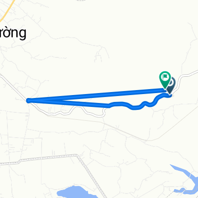
 J14 — Jeudi 18 janvier 2018 – Gia Ray – Phu Thuy
- Distance
- 95.4 km
- Ascent
- 76 m
- Descent
- 227 m
- Location
- Gia Ray, Đồng Nai Province, Vietnam
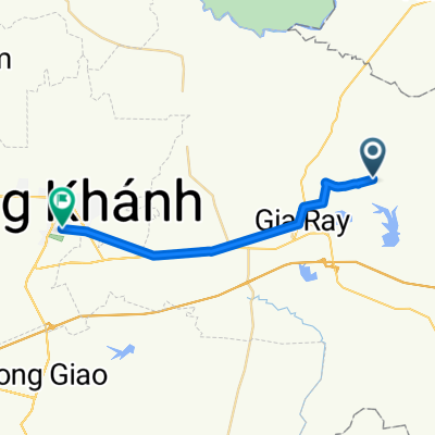
 test J1
- Distance
- 68.2 km
- Ascent
- 219 m
- Descent
- 374 m
- Location
- Gia Ray, Đồng Nai Province, Vietnam
 Restful route
- Distance
- 7.2 km
- Ascent
- 32 m
- Descent
- 34 m
- Location
- Gia Ray, Đồng Nai Province, Vietnam
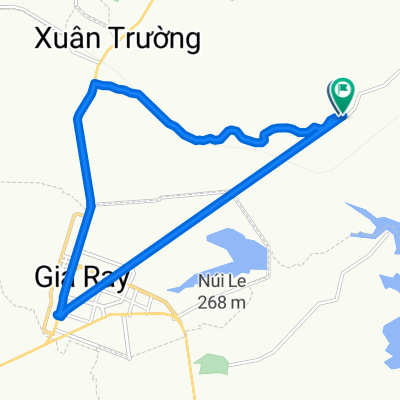
 Moderate route
- Distance
- 26.2 km
- Ascent
- 312 m
- Descent
- 251 m
- Location
- Gia Ray, Đồng Nai Province, Vietnam
 Moderate route
- Distance
- 18.8 km
- Ascent
- 56 m
- Descent
- 87 m
- Location
- Gia Ray, Đồng Nai Province, Vietnam
Open it in the app