J15 — Vendredi 19 janvier 2018 – Phu Thuy – Lien Huong
- 90.1 km
- 284 m
- 274 m
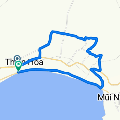
- Phan Thiết, Bình Thuận Province, Vietnam
A cycling route starting in Phan Thiết, Bình Thuận Province, Vietnam.
Overview
J15 — Friday, January 19, 2018 – Phu Thuy – Lien Huong
The display of the counter has become unreadable, probably due to humidity. The data below are from Locus for distance and average speed and from Bikemap for the elevation gain. The elevation loss and the maximum slope percentages are estimated.
Distance traveled: 90.20 km - Average: 12 km/h
Elevation gain: 300 m - Maximum climbing slope: 9 %
Elevation loss: 320 m - Maximum descending slope: 6 %
Starting altitude: 29 m - Arrival altitude: 9 m - Maximum altitude: 113 m
created this 7 years ago
Route quality
Quiet road
18.9 km
(21 %)
Road
4.5 km
(5 %)
Paved
9 km
(10 %)
Unpaved
3.6 km
(4 %)
Asphalt
9 km
(10 %)
Unpaved (undefined)
3.6 km
(4 %)
Undefined
77.5 km
(86 %)
Continue with Bikemap
You would like to ride J15 — Vendredi 19 janvier 2018 – Phu Thuy – Lien Huong or customize it for your own trip? Here is what you can do with this Bikemap route:
Free trial for 3 days, or one-time payment. More about Bikemap Premium.
Discover more Premium features.
Get Bikemap PremiumFrom our community
Open it in the app