

D 028: Breisach - Kaiseraugst
A cycling route starting in Algolsheim, Grand Est, France.
Overview
About this route
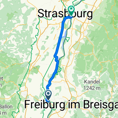
(D 027-) BREISACH - Rhein - NEUENBURG - Steinenstadt - Rhein - BAD BELLINGEN - Blansingen - Efringen-Kirchen - Weil am Rhein - Rhein - BASEL - Rhein - Grenzach - Wyhlen - Rheinbrücke - CH-KAISERAUGST (- CH 001)
ALTERNATIVE: Zwischen Neuenburg und Weil flach am Rhein bleiben!
- -:--
- Duration
- 77 km
- Distance
- 257 m
- Ascent
- 189 m
- Descent
- ---
- Avg. speed
- ---
- Max. altitude
Route quality
Waytypes & surfaces along the route
Waytypes
Quiet road
28.9 km
(38 %)
Track
18.5 km
(24 %)
Surfaces
Paved
43.4 km
(56 %)
Unpaved
22.9 km
(30 %)
Asphalt
39.6 km
(51 %)
Gravel
20.5 km
(27 %)
Route highlights
Points of interest along the route
Accommodation after 69.1 km
Hotel Eckert
Accommodation after 69.2 km
Hotel Viletta
Accommodation after 76 km
Hotel ibis budget Basel Pratteln
Accommodation after 76 km
Hotel/Rest. Zum krummen Eich
Continue with Bikemap
Use, edit, or download this cycling route
You would like to ride D 028: Breisach - Kaiseraugst or customize it for your own trip? Here is what you can do with this Bikemap route:
Free features
- Save this route as favorite or in collections
- Copy & plan your own version of this route
- Sync your route with Garmin or Wahoo
Premium features
Free trial for 3 days, or one-time payment. More about Bikemap Premium.
- Navigate this route on iOS & Android
- Export a GPX / KML file of this route
- Create your custom printout (try it for free)
- Download this route for offline navigation
Discover more Premium features.
Get Bikemap PremiumFrom our community
Other popular routes starting in Algolsheim
 D 028: Breisach - Kaiseraugst
- Distance
- 77 km
- Ascent
- 257 m
- Descent
- 189 m
- Location
- Algolsheim, Grand Est, France
 Tour du KAISERSTUHL
- Distance
- 60.3 km
- Ascent
- 47 m
- Descent
- 50 m
- Location
- Algolsheim, Grand Est, France
 CYCLING THE RHINE: Route 18B
- Distance
- 23.7 km
- Ascent
- 43 m
- Descent
- 35 m
- Location
- Algolsheim, Grand Est, France
 CYCLING THE RHINE: Route 18B
- Distance
- 23.7 km
- Ascent
- 35 m
- Descent
- 32 m
- Location
- Algolsheim, Grand Est, France
 Kaiserstuhlrunde
- Distance
- 62.7 km
- Ascent
- 267 m
- Descent
- 251 m
- Location
- Algolsheim, Grand Est, France
 Breisach am Rhein Stève 04/2025
- Distance
- 64 km
- Ascent
- 363 m
- Descent
- 363 m
- Location
- Algolsheim, Grand Est, France
 Breisach1
- Distance
- 55.5 km
- Ascent
- 342 m
- Descent
- 339 m
- Location
- Algolsheim, Grand Est, France
 #10 Hotel Breisacher Hof to Rosegarden
- Distance
- 72.7 km
- Ascent
- 32 m
- Descent
- 82 m
- Location
- Algolsheim, Grand Est, France
Open it in the app