
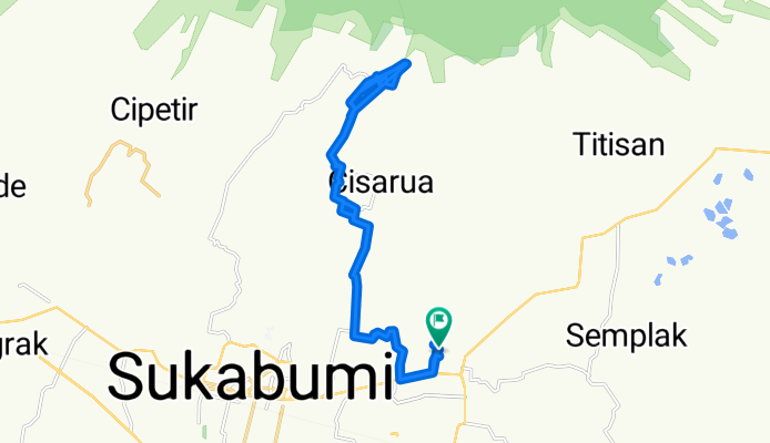
puncak pondok halimun sukabumi gunung pangrango
A cycling route starting in Sukabumi, West Java, Indonesia.
Overview
About this route
- 5 h 52 min
- Duration
- 31.9 km
- Distance
- 753 m
- Ascent
- 752 m
- Descent
- 5.4 km/h
- Avg. speed
- ---
- Max. altitude

Continue with Bikemap
Use, edit, or download this cycling route
You would like to ride puncak pondok halimun sukabumi gunung pangrango or customize it for your own trip? Here is what you can do with this Bikemap route:
Free features
- Save this route as favorite or in collections
- Copy & plan your own version of this route
- Sync your route with Garmin or Wahoo
Premium features
Free trial for 3 days, or one-time payment. More about Bikemap Premium.
- Navigate this route on iOS & Android
- Export a GPX / KML file of this route
- Create your custom printout (try it for free)
- Download this route for offline navigation
Discover more Premium features.
Get Bikemap PremiumFrom our community
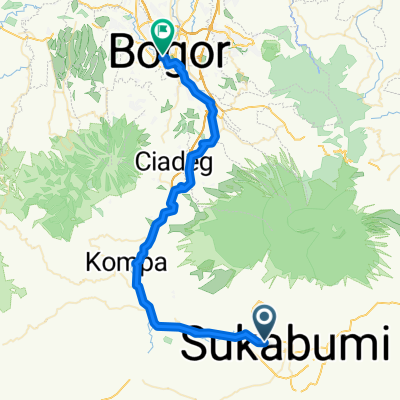
Other popular routes starting in Sukabumi
 puncak pondok halimun sukabumi gunung pangrango
- Distance
- 31.9 km
- Ascent
- 753 m
- Descent
- 752 m
- Location
- Sukabumi, West Java, Indonesia
 3V9H+5WF, Kecamatan Gunung Guruh to Jalan Perum Mangkalaya 1, Kecamatan Gunung Guruh
- Distance
- 83.5 km
- Ascent
- 314 m
- Descent
- 312 m
- Location
- Sukabumi, West Java, Indonesia
 2nd route
- Distance
- 14.3 km
- Ascent
- 554 m
- Descent
- 420 m
- Location
- Sukabumi, West Java, Indonesia
 Sukabumi Situ Gunung (plan)
- Distance
- 23.2 km
- Ascent
- 559 m
- Descent
- 559 m
- Location
- Sukabumi, West Java, Indonesia
 SU-BGR
- Distance
- 67.4 km
- Ascent
- 320 m
- Descent
- 665 m
- Location
- Sukabumi, West Java, Indonesia
 3V9H+5RG, Kecamatan Gunung Guruh to Jalan Perum Mangkalaya 1, Kecamatan Gunung Guruh
- Distance
- 23.5 km
- Ascent
- 553 m
- Descent
- 553 m
- Location
- Sukabumi, West Java, Indonesia
 Jalan Tanjung 40, Kecamatan Sukabumi to Jalan Raya Cisaat 208, Kecamatan Cisaat
- Distance
- 14 km
- Ascent
- 162 m
- Descent
- 71 m
- Location
- Sukabumi, West Java, Indonesia
 3V9H+5RG, Kecamatan Gunung Guruh to Jalan Cipanengah Girang, Kecamatan Warudoyong
- Distance
- 7.8 km
- Ascent
- 335 m
- Descent
- 419 m
- Location
- Sukabumi, West Java, Indonesia
Open it in the app