

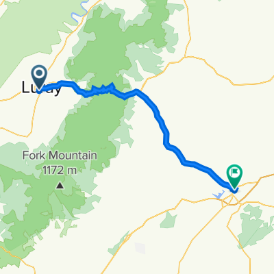
rileyville au nord de luray
A cycling route starting in Luray, Virginia, United States.
Overview
About this route
- -:--
- Duration
- 22.8 km
- Distance
- 273 m
- Ascent
- 275 m
- Descent
- ---
- Avg. speed
- ---
- Max. altitude
Route quality
Waytypes & surfaces along the route
Waytypes
Quiet road
20.5 km
(90 %)
Access road
0.9 km
(4 %)
Surfaces
Paved
13.2 km
(58 %)
Paved (undefined)
13.2 km
(58 %)
Undefined
9.6 km
(42 %)
Continue with Bikemap
Use, edit, or download this cycling route
You would like to ride rileyville au nord de luray or customize it for your own trip? Here is what you can do with this Bikemap route:
Free features
- Save this route as favorite or in collections
- Copy & plan your own version of this route
- Sync your route with Garmin or Wahoo
Premium features
Free trial for 3 days, or one-time payment. More about Bikemap Premium.
- Navigate this route on iOS & Android
- Export a GPX / KML file of this route
- Create your custom printout (try it for free)
- Download this route for offline navigation
Discover more Premium features.
Get Bikemap PremiumFrom our community
Other popular routes starting in Luray
 Easy day trip
- Distance
- 116.8 km
- Ascent
- 839 m
- Descent
- 839 m
- Location
- Luray, Virginia, United States
 Front Royal Loop
- Distance
- 131.5 km
- Ascent
- 1,519 m
- Descent
- 1,519 m
- Location
- Luray, Virginia, United States
 Redgate and Old Rag
- Distance
- 113.9 km
- Ascent
- 2,126 m
- Descent
- 2,126 m
- Location
- Luray, Virginia, United States
 Short Mountain Long Ride
- Distance
- 144.8 km
- Ascent
- 2,171 m
- Descent
- 2,176 m
- Location
- Luray, Virginia, United States
 South Court Street 159, Luray to Culpeper Station
- Distance
- 58.5 km
- Ascent
- 897 m
- Descent
- 1,031 m
- Location
- Luray, Virginia, United States
 petite boucle de Luray va
- Distance
- 31.3 km
- Ascent
- 251 m
- Descent
- 252 m
- Location
- Luray, Virginia, United States
 rileyville au nord de luray
- Distance
- 22.8 km
- Ascent
- 273 m
- Descent
- 275 m
- Location
- Luray, Virginia, United States
 Blueridge jour 2 Iti ( A ) Départ Skyland
- Distance
- 109.4 km
- Ascent
- 1,026 m
- Descent
- 1,719 m
- Location
- Luray, Virginia, United States
Open it in the app