

Day 2
A cycling route starting in Kagoshima, Kagoshima, Japan.
Overview
About this route
- -:--
- Duration
- 91.6 km
- Distance
- 1,163 m
- Ascent
- 1,163 m
- Descent
- ---
- Avg. speed
- ---
- Max. altitude

Continue with Bikemap
Use, edit, or download this cycling route
You would like to ride Day 2 or customize it for your own trip? Here is what you can do with this Bikemap route:
Free features
- Save this route as favorite or in collections
- Copy & plan your own version of this route
- Split it into stages to create a multi-day tour
- Sync your route with Garmin or Wahoo
Premium features
Free trial for 3 days, or one-time payment. More about Bikemap Premium.
- Navigate this route on iOS & Android
- Export a GPX / KML file of this route
- Create your custom printout (try it for free)
- Download this route for offline navigation
Discover more Premium features.
Get Bikemap PremiumFrom our community
Other popular routes starting in Kagoshima
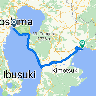
 Kagoshima to Ibusuki
- Distance
- 47.2 km
- Ascent
- 188 m
- Descent
- 196 m
- Location
- Kagoshima, Kagoshima, Japan
 miyazaki Strandrunde Variante 2
- Distance
- 198.9 km
- Ascent
- 3,073 m
- Descent
- 3,088 m
- Location
- Kagoshima, Kagoshima, Japan
 Sakurajima_Sisusi
- Distance
- 82.7 km
- Ascent
- 284 m
- Descent
- 278 m
- Location
- Kagoshima, Kagoshima, Japan
 日本2017
- Distance
- 2,052 km
- Ascent
- 4,142 m
- Descent
- 3,294 m
- Location
- Kagoshima, Kagoshima, Japan
 Kagoschima-Hyuga
- Distance
- 325.6 km
- Ascent
- 698 m
- Descent
- 712 m
- Location
- Kagoshima, Kagoshima, Japan
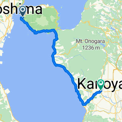 Kagoshima to Kanoya
- Distance
- 53.3 km
- Ascent
- 277 m
- Descent
- 254 m
- Location
- Kagoshima, Kagoshima, Japan
 Japan 2
- Distance
- 1,839.6 km
- Ascent
- 3,218 m
- Descent
- 3,225 m
- Location
- Kagoshima, Kagoshima, Japan
 Day 2
Day 2- Distance
- 91.6 km
- Ascent
- 1,163 m
- Descent
- 1,163 m
- Location
- Kagoshima, Kagoshima, Japan
Open it in the app