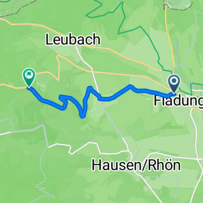
Wurmbergstraße nach Hauptstraße
- 20.8 km
- 31 m
- 208 m
- Fladungen, Bavaria, Germany
A cycling route starting in Fladungen, Bavaria, Germany.
Overview
Stage four (54 km) of the 265-kilometer multi-day tour along the Franconian Rhön rivers.
From Fladungen, the route turns southwards. Along the High Rhön, it passes through ancient farming villages to Oberelsbach, home to the Bavarian Rhön Nature Parks and the Bavarian administration of the biosphere reserve with the information centre Haus der Langen Rhön. The Tobacco Pipe Museum and the Valentin-Rathgeber Museum (named after the famous Baroque composer from Oberelsbach) are located nearby. Bischofsheim and Kreuzberg are not only geographically connected but also form a tourist unit. Here the climb begins to the pass between the Brend and Sinn valleys. Shortly after Oberweißenbrunn, this climb is overcome and the route descends, mostly along paved cycle paths past the Schwarze Berge information centre down to Bad Brückenau, the last spa town on the route.
Length: 53.7 km
Elevation gain: 572 m
Duration: 3:35 hours
Highest point: 658 m
Start location: Fladungen
Characteristics: easy to moderately difficult multi-day cycling tour on mostly very well rideable paths with a longer ascent
Access: by car via the A 71 Mellrichstadt exit; by train from Schweinfurt or Erfurt to Mellrichstadt
Experience value: high (great nature and landscape experience); <br />Worth seeing: Fladungen, Bischofsheim, bike museum in Staatsbad Brückenau
Signposting: the route is marked with white-green signposts indicating destinations and distances
Literature: Jochen Heinke 'By Bicycle and Luggage from the Main to the Rhön' Parzellers Buchverlag Fulda ISBN 978-3-7900-0393-2; Fritsch cycling map Nature Park and Biosphere Reserve Rhön ISBN3-86116-568-6
created this 15 years ago
Route quality
Track
21.4 km
(40 %)
Quiet road
15 km
(28 %)
Paved
41.2 km
(77 %)
Unpaved
4.8 km
(9 %)
Asphalt
36.4 km
(68 %)
Paved (undefined)
4.8 km
(9 %)
Continue with Bikemap
You would like to ride Radwanderweg Vom Main zur Rhön Etappe 4 or customize it for your own trip? Here is what you can do with this Bikemap route:
Free trial for 3 days, or one-time payment. More about Bikemap Premium.
Discover more Premium features.
Get Bikemap PremiumFrom our community
Open it in the app