

Von Torbole ins Umland
Torbole um Monte Baldo
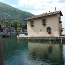
A cycling route starting in Torbole sul Garda, Trentino-Alto Adige, Italy.
Overview
About this route
From Torbole, the bike path to Mori begins climbing the Via Europa with a considerable incline. After a short time, you'll already have a beautiful view of Lake Garda. Through Mori, the Claudia-Augusta bike path mainly runs alongside the Etscht-Adige. Under the Brenner at Canale, you'll cross Monte Baldo to reach Garda. Here, I recommend a break for ice cream with a view of Lake Garda. The return is always alongside the lake. Since the wind usually comes from the south after noon, this is quite fast.
- -:--
- Duration
- 108.5 km
- Distance
- 1,224 m
- Ascent
- 1,224 m
- Descent
- ---
- Avg. speed
- 285 m
- Max. altitude

Part of
6 stages
Route photos


Route quality
Waytypes & surfaces along the route
Waytypes
Cycleway
22.8 km
(21 %)
Quiet road
15.2 km
(14 %)
Surfaces
Paved
103.1 km
(95 %)
Asphalt
103.1 km
(95 %)
Undefined
5.4 km
(5 %)
Continue with Bikemap
Use, edit, or download this cycling route
You would like to ride Torbole um Monte Baldo or customize it for your own trip? Here is what you can do with this Bikemap route:
Free features
- Save this route as favorite or in collections
- Copy & plan your own version of this route
- Split it into stages to create a multi-day tour
- Sync your route with Garmin or Wahoo
Premium features
Free trial for 3 days, or one-time payment. More about Bikemap Premium.
- Navigate this route on iOS & Android
- Export a GPX / KML file of this route
- Create your custom printout (try it for free)
- Download this route for offline navigation
Discover more Premium features.
Get Bikemap PremiumFrom our community
Other popular routes starting in Torbole sul Garda
 MB Tour St. Barbara
- Distance
- 31.4 km
- Ascent
- 1,394 m
- Descent
- 1,175 m
- Location
- Torbole sul Garda, Trentino-Alto Adige, Italy
 MB Tour Dosso dei Roveri
- Distance
- 30.3 km
- Ascent
- 1,266 m
- Descent
- 1,269 m
- Location
- Torbole sul Garda, Trentino-Alto Adige, Italy
 Torbole - Capanna Grassi
- Distance
- 31.1 km
- Ascent
- 1,275 m
- Descent
- 849 m
- Location
- Torbole sul Garda, Trentino-Alto Adige, Italy
 Garda M01 (Nago)
- Distance
- 8.4 km
- Ascent
- 214 m
- Descent
- 213 m
- Location
- Torbole sul Garda, Trentino-Alto Adige, Italy
 Monte Velo
- Distance
- 47.1 km
- Ascent
- 1,314 m
- Descent
- 1,315 m
- Location
- Torbole sul Garda, Trentino-Alto Adige, Italy
 140717 monte baldo
- Distance
- 49.4 km
- Ascent
- 2,329 m
- Descent
- 2,329 m
- Location
- Torbole sul Garda, Trentino-Alto Adige, Italy
 MB Tour Sosso dei Roveri 2
- Distance
- 33.9 km
- Ascent
- 1,348 m
- Descent
- 1,351 m
- Location
- Torbole sul Garda, Trentino-Alto Adige, Italy
 Riva del Garda-Lago di Tenno-Arco-Torbole
- Distance
- 41.3 km
- Ascent
- 741 m
- Descent
- 726 m
- Location
- Torbole sul Garda, Trentino-Alto Adige, Italy
Open it in the app