

hhhhh
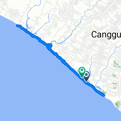
A cycling route starting in Banjar Kerobokan, Bali, Indonesia.
Overview
About this route
- 1 h 42 min
- Duration
- 25.5 km
- Distance
- 129 m
- Ascent
- 133 m
- Descent
- 15.1 km/h
- Avg. speed
- ---
- Max. altitude

Route quality
Waytypes & surfaces along the route
Waytypes
Road
8.8 km
(35 %)
Busy road
8.6 km
(34 %)
Surfaces
Paved
15.5 km
(61 %)
Asphalt
15.1 km
(59 %)
Paving stones
0.4 km
(2 %)
Undefined
10 km
(39 %)
Continue with Bikemap
Use, edit, or download this cycling route
You would like to ride hhhhh or customize it for your own trip? Here is what you can do with this Bikemap route:
Free features
- Save this route as favorite or in collections
- Copy & plan your own version of this route
- Sync your route with Garmin or Wahoo
Premium features
Free trial for 3 days, or one-time payment. More about Bikemap Premium.
- Navigate this route on iOS & Android
- Export a GPX / KML file of this route
- Create your custom printout (try it for free)
- Download this route for offline navigation
Discover more Premium features.
Get Bikemap PremiumFrom our community
Other popular routes starting in Banjar Kerobokan
 Canggu - Jatiluwih
- Distance
- 87.8 km
- Ascent
- 731 m
- Descent
- 725 m
- Location
- Banjar Kerobokan, Bali, Indonesia
 Route to Jalan Pantai Batu Bolong 117x, Kecamatan Kuta Utara
- Distance
- 6.3 km
- Ascent
- 77 m
- Descent
- 78 m
- Location
- Banjar Kerobokan, Bali, Indonesia
 Pererenan - Sofitel
- Distance
- 30.6 km
- Ascent
- 116 m
- Descent
- 119 m
- Location
- Banjar Kerobokan, Bali, Indonesia
 Jalan By Pass Tanah Lot, Kecamatan Kediri to Jalan Bumbak Dauh 84, Kecamatan Kuta Utara
- Distance
- 7.8 km
- Ascent
- 33 m
- Descent
- 27 m
- Location
- Banjar Kerobokan, Bali, Indonesia
 Jalan Pantai Pererenan, Badung to Jalan Sunset Road, Badung
- Distance
- 15 km
- Ascent
- 7 m
- Descent
- 0 m
- Location
- Banjar Kerobokan, Bali, Indonesia
 Gajah Mina Beach Resort
- Distance
- 34.2 km
- Ascent
- 374 m
- Descent
- 367 m
- Location
- Banjar Kerobokan, Bali, Indonesia
 Kuta Utara, Kabupaten Badung to Kuta Utara, Kabupaten Badung
- Distance
- 9.1 km
- Ascent
- 52 m
- Descent
- 52 m
- Location
- Banjar Kerobokan, Bali, Indonesia
 84QP+Q6W, Kuta Utara to Jalan Raya Kesambi No 18, Kecamatan Kuta Utara
- Distance
- 6.1 km
- Ascent
- 55 m
- Descent
- 26 m
- Location
- Banjar Kerobokan, Bali, Indonesia
Open it in the app