

Von Ritterhude nach Val de Reuil
1. Etappe Ritterhude-Val de Reuil
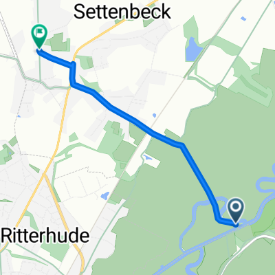
A cycling route starting in Ritterhude, Lower Saxony, Germany.
Overview
About this route
- Etappe von Ritterhude nach Reken. Ziel ist die Jugendherberge in Reken, Coesfelderstr. 18
- -:--
- Duration
- 269.7 km
- Distance
- 455 m
- Ascent
- 378 m
- Descent
- ---
- Avg. speed
- ---
- Max. altitude

Part of

Von Ritterhude nach Val de Reuil
1 stage
Route quality
Waytypes & surfaces along the route
Waytypes
Path
132.1 km
(49 %)
Quiet road
37.8 km
(14 %)
Surfaces
Paved
223.8 km
(83 %)
Unpaved
2.7 km
(1 %)
Asphalt
215.7 km
(80 %)
Paved (undefined)
8.1 km
(3 %)
Continue with Bikemap
Use, edit, or download this cycling route
You would like to ride 1. Etappe Ritterhude-Val de Reuil or customize it for your own trip? Here is what you can do with this Bikemap route:
Free features
- Save this route as favorite or in collections
- Copy & plan your own version of this route
- Split it into stages to create a multi-day tour
- Sync your route with Garmin or Wahoo
Premium features
Free trial for 3 days, or one-time payment. More about Bikemap Premium.
- Navigate this route on iOS & Android
- Export a GPX / KML file of this route
- Create your custom printout (try it for free)
- Download this route for offline navigation
Discover more Premium features.
Get Bikemap PremiumFrom our community
Other popular routes starting in Ritterhude
 Lesum/Wümme Tour
- Distance
- 14.6 km
- Ascent
- 44 m
- Descent
- 43 m
- Location
- Ritterhude, Lower Saxony, Germany
 Lesumstotel - Neuenkirchen - Lesumstotel
- Distance
- 56.9 km
- Ascent
- 131 m
- Descent
- 131 m
- Location
- Ritterhude, Lower Saxony, Germany
 Wümme Radweg
- Distance
- 31.2 km
- Ascent
- 7 m
- Descent
- 6 m
- Location
- Ritterhude, Lower Saxony, Germany
 Heilshorn, Garlstedt
- Distance
- 37.8 km
- Ascent
- 112 m
- Descent
- 98 m
- Location
- Ritterhude, Lower Saxony, Germany
 Brötchenrunde
- Distance
- 15.6 km
- Ascent
- 61 m
- Descent
- 63 m
- Location
- Ritterhude, Lower Saxony, Germany
 Heilshorn, Garlstedt, Stotler Forst
- Distance
- 41.9 km
- Ascent
- 121 m
- Descent
- 121 m
- Location
- Ritterhude, Lower Saxony, Germany
 Kurze Runde für Zwischendurch
- Distance
- 46.9 km
- Ascent
- 56 m
- Descent
- 58 m
- Location
- Ritterhude, Lower Saxony, Germany
 Ruschkamp - Scharmbeckstotel
- Distance
- 3 km
- Ascent
- 36 m
- Descent
- 0 m
- Location
- Ritterhude, Lower Saxony, Germany
Open it in the app