

Rajd dni os. Pobitno. v.3
A cycling route starting in Rzeszów, Subcarpathian Voivodeship, Poland.
Overview
About this route
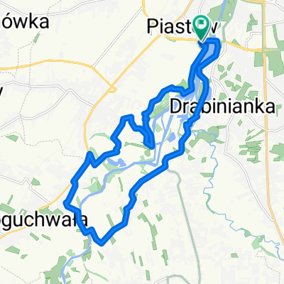
Start MDK Pobitno, Meta SP. nr . 12. Main goal - Ulm family museum in Markowa. Stops along the way: Dębina Forest, MOR Krzemienica, MOR Łańcut.
- -:--
- Duration
- 57.9 km
- Distance
- 215 m
- Ascent
- 214 m
- Descent
- ---
- Avg. speed
- ---
- Max. altitude

Route quality
Waytypes & surfaces along the route
Waytypes
Quiet road
26.1 km
(45 %)
Road
16.8 km
(29 %)
Surfaces
Paved
48.1 km
(83 %)
Unpaved
2.9 km
(5 %)
Asphalt
48.1 km
(83 %)
Unpaved (undefined)
2.9 km
(5 %)
Undefined
6.9 km
(12 %)
Route highlights
Points of interest along the route
Point of interest after 5.7 km
1 postój, Las Dębina
Point of interest after 18.7 km
2 postój, MOR Łańcut Polna
Point of interest after 23.6 km
3 postój - MOR Łańcut Zamek
Point of interest after 32.4 km
4 postój - Muzeum rodziny Ulmów w Markowej
Point of interest after 40.2 km
Postój, Stary Młyn
Point of interest after 51 km
Postój - LKS Strumyk Malawa
Continue with Bikemap
Use, edit, or download this cycling route
You would like to ride Rajd dni os. Pobitno. v.3 or customize it for your own trip? Here is what you can do with this Bikemap route:
Free features
- Save this route as favorite or in collections
- Copy & plan your own version of this route
- Sync your route with Garmin or Wahoo
Premium features
Free trial for 3 days, or one-time payment. More about Bikemap Premium.
- Navigate this route on iOS & Android
- Export a GPX / KML file of this route
- Create your custom printout (try it for free)
- Download this route for offline navigation
Discover more Premium features.
Get Bikemap PremiumFrom our community
Other popular routes starting in Rzeszów
 Boguchwała
- Distance
- 19.4 km
- Ascent
- 71 m
- Descent
- 71 m
- Location
- Rzeszów, Subcarpathian Voivodeship, Poland
 Rzeszów Skandia Maraton Lang Team 2010 Mini
- Distance
- 31.1 km
- Ascent
- 477 m
- Descent
- 480 m
- Location
- Rzeszów, Subcarpathian Voivodeship, Poland
 Trasa 2
- Distance
- 14.9 km
- Ascent
- 14 m
- Descent
- 13 m
- Location
- Rzeszów, Subcarpathian Voivodeship, Poland
![[V] #054 Babia Góra](https://media.bikemap.net/routes/7432964/staticmaps/in_34552177-a112-4354-9da4-48307a0dcf74_400x400_bikemap-2021-3D-static.png) [V] #054 Babia Góra
[V] #054 Babia Góra- Distance
- 38.4 km
- Ascent
- 220 m
- Descent
- 219 m
- Location
- Rzeszów, Subcarpathian Voivodeship, Poland
 Rzeszów, Terliczka, Czarna, Łańcut, Kraczkowa, Malawa, Rzeszów
- Distance
- 43 km
- Ascent
- 119 m
- Descent
- 122 m
- Location
- Rzeszów, Subcarpathian Voivodeship, Poland
 Rzeszów - Przylasek - Sołonka - Babica - Krzyż Milenijny - Rzeszów
- Distance
- 64.5 km
- Ascent
- 598 m
- Descent
- 598 m
- Location
- Rzeszów, Subcarpathian Voivodeship, Poland
 Wisząca kładka
- Distance
- 17.6 km
- Ascent
- 114 m
- Descent
- 122 m
- Location
- Rzeszów, Subcarpathian Voivodeship, Poland
 Zalew Czyste, Grodzisko dolne
- Distance
- 90.2 km
- Ascent
- 62 m
- Descent
- 62 m
- Location
- Rzeszów, Subcarpathian Voivodeship, Poland
Open it in the app