

TDB 2018
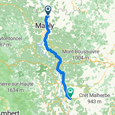
Tour de Bourgogne - Etape 2 de Melay à Decize - 131km 360D+
A cycling route starting in Briennon, Auvergne-Rhône-Alpes, France.
Overview
About this route
Etape Camping des Halles
Aquadis Loisirs
Allée Marcel Merle 58300 Decize
- -:--
- Duration
- 131.3 km
- Distance
- 246 m
- Ascent
- 326 m
- Descent
- ---
- Avg. speed
- ---
- Max. altitude

Part of
TDB 2018
8 stages
Route quality
Waytypes & surfaces along the route
Waytypes
Quiet road
56.5 km
(43 %)
Road
21 km
(16 %)
Surfaces
Paved
38.1 km
(29 %)
Asphalt
38.1 km
(29 %)
Undefined
93.2 km
(71 %)
Continue with Bikemap
Use, edit, or download this cycling route
You would like to ride Tour de Bourgogne - Etape 2 de Melay à Decize - 131km 360D+ or customize it for your own trip? Here is what you can do with this Bikemap route:
Free features
- Save this route as favorite or in collections
- Copy & plan your own version of this route
- Split it into stages to create a multi-day tour
- Sync your route with Garmin or Wahoo
Premium features
Free trial for 3 days, or one-time payment. More about Bikemap Premium.
- Navigate this route on iOS & Android
- Export a GPX / KML file of this route
- Create your custom printout (try it for free)
- Download this route for offline navigation
Discover more Premium features.
Get Bikemap PremiumFrom our community
Other popular routes starting in Briennon
 Le Benisson-Dieu to Belleville
- Distance
- 63.7 km
- Ascent
- 508 m
- Descent
- 605 m
- Location
- Briennon, Auvergne-Rhône-Alpes, France
 Parcours Minimes 2
- Distance
- 24.9 km
- Ascent
- 253 m
- Descent
- 184 m
- Location
- Briennon, Auvergne-Rhône-Alpes, France
 Briennon - Bellegarde-en-Forez
- Distance
- 77.2 km
- Ascent
- 751 m
- Descent
- 626 m
- Location
- Briennon, Auvergne-Rhône-Alpes, France
 Parcours Poussins 1
- Distance
- 6.3 km
- Ascent
- 51 m
- Descent
- 51 m
- Location
- Briennon, Auvergne-Rhône-Alpes, France
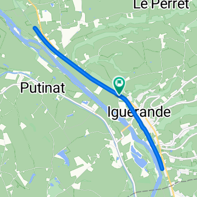 De Voie Verte (Iguerande - Montceaux-l'Étoile) à Voie Verte (Iguerande - Montceaux-l'Étoile)
- Distance
- 8.5 km
- Ascent
- 102 m
- Descent
- 107 m
- Location
- Briennon, Auvergne-Rhône-Alpes, France
 Le Colombier, Iguerande naar Chez Jean, Le Breuil
- Distance
- 48.2 km
- Ascent
- 682 m
- Descent
- 616 m
- Location
- Briennon, Auvergne-Rhône-Alpes, France
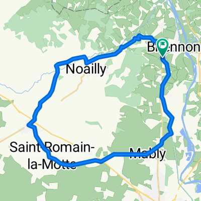 De 89 Route de Roanne, Briennon à 89 Route de Roanne, Briennon
- Distance
- 31.5 km
- Ascent
- 207 m
- Descent
- 205 m
- Location
- Briennon, Auvergne-Rhône-Alpes, France
 Briennon - Decize
- Distance
- 118.7 km
- Ascent
- 179 m
- Descent
- 276 m
- Location
- Briennon, Auvergne-Rhône-Alpes, France
Open it in the app