

TDB 2018
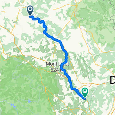
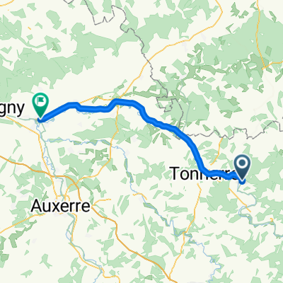
Tour de Bourgogne - Etape 6 de Lézinnes à Recey sur Ource - 123km 1230D+
A cycling route starting in Tanlay, Bourgogne-Franche-Comté, France.
Overview
About this route
Etape Camping Pays Chatillonnais
21280 Recey sur Ource
- -:--
- Duration
- 123.4 km
- Distance
- 930 m
- Ascent
- 800 m
- Descent
- ---
- Avg. speed
- ---
- Max. altitude

Part of
TDB 2018
8 stages
Route quality
Waytypes & surfaces along the route
Waytypes
Road
61.7 km
(50 %)
Quiet road
21 km
(17 %)
Surfaces
Paved
7.4 km
(6 %)
Unpaved
13.6 km
(11 %)
Gravel
13.6 km
(11 %)
Asphalt
7.4 km
(6 %)
Undefined
102.4 km
(83 %)
Continue with Bikemap
Use, edit, or download this cycling route
You would like to ride Tour de Bourgogne - Etape 6 de Lézinnes à Recey sur Ource - 123km 1230D+ or customize it for your own trip? Here is what you can do with this Bikemap route:
Free features
- Save this route as favorite or in collections
- Copy & plan your own version of this route
- Split it into stages to create a multi-day tour
- Sync your route with Garmin or Wahoo
Premium features
Free trial for 3 days, or one-time payment. More about Bikemap Premium.
- Navigate this route on iOS & Android
- Export a GPX / KML file of this route
- Create your custom printout (try it for free)
- Download this route for offline navigation
Discover more Premium features.
Get Bikemap PremiumFrom our community
Other popular routes starting in Tanlay
 E2 Lézines_venarey-les-Laumes
- Distance
- 86.4 km
- Ascent
- 553 m
- Descent
- 486 m
- Location
- Tanlay, Bourgogne-Franche-Comté, France
 Tour de Bourgogne - Etape 6 de Lézinnes à Recey sur Ource - 123km 1230D+
- Distance
- 123.4 km
- Ascent
- 930 m
- Descent
- 800 m
- Location
- Tanlay, Bourgogne-Franche-Comté, France
 2020-JR4-Lézinnes-Lac d'Orient
- Distance
- 74 km
- Ascent
- 401 m
- Descent
- 413 m
- Location
- Tanlay, Bourgogne-Franche-Comté, France
 De 2 Grande Rue, Tanlay à 13 Rue de l'Église, Ancy-le-Libre
- Distance
- 9.4 km
- Ascent
- 24 m
- Descent
- 18 m
- Location
- Tanlay, Bourgogne-Franche-Comté, France
 FR2-08_Tanlay_Pouillenay_73,2km 200hm
- Distance
- 75.6 km
- Ascent
- 224 m
- Descent
- 121 m
- Location
- Tanlay, Bourgogne-Franche-Comté, France
 Tanlay - Pouilly-en-Auxois
- Distance
- 104.2 km
- Ascent
- 401 m
- Descent
- 220 m
- Location
- Tanlay, Bourgogne-Franche-Comté, France
 Tanlay - Migennes
- Distance
- 52.7 km
- Ascent
- 8 m
- Descent
- 72 m
- Location
- Tanlay, Bourgogne-Franche-Comté, France
 E2 Lézinnes>Migénnes
- Distance
- 62.4 km
- Ascent
- 222 m
- Descent
- 147 m
- Location
- Tanlay, Bourgogne-Franche-Comté, France
Open it in the app