

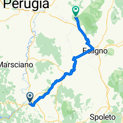
Todi-Marsciano-Ponte S.Giovanni-Umbertide
A cycling route starting in Todi, Umbria, Italy.
Overview
About this route
If you ride in reverse on a mountain bike along the river route of the Tiber, using secondary and unpaved roads.
From Todi, you descend to Pontecuti and merge onto the dirt road that runs alongside the Tiber. The route, alternating between dirt and asphalt, reaches Pian di San Martino, the outskirts of Fratta Todina, Marsciano, Deruta, Torgiano, Ponte S. Giovanni, Ponte Valleceppi, Ponte Felcino, Villa Pitignano, the crossroads at Ponte Pattoli, the crossroads at Pierantonio, to finally arrive in Umbertide.
- -:--
- Duration
- 96.5 km
- Distance
- 285 m
- Ascent
- 449 m
- Descent
- ---
- Avg. speed
- ---
- Max. altitude
Route quality
Waytypes & surfaces along the route
Waytypes
Quiet road
34.8 km
(36 %)
Track
16.4 km
(17 %)
Surfaces
Paved
26.1 km
(27 %)
Unpaved
27 km
(28 %)
Asphalt
26.1 km
(27 %)
Loose gravel
14.5 km
(15 %)
Continue with Bikemap
Use, edit, or download this cycling route
You would like to ride Todi-Marsciano-Ponte S.Giovanni-Umbertide or customize it for your own trip? Here is what you can do with this Bikemap route:
Free features
- Save this route as favorite or in collections
- Copy & plan your own version of this route
- Split it into stages to create a multi-day tour
- Sync your route with Garmin or Wahoo
Premium features
Free trial for 3 days, or one-time payment. More about Bikemap Premium.
- Navigate this route on iOS & Android
- Export a GPX / KML file of this route
- Create your custom printout (try it for free)
- Download this route for offline navigation
Discover more Premium features.
Get Bikemap PremiumFrom our community
Other popular routes starting in Todi
 Todi-Marsciano-Ponte S.Giovanni-Umbertide
- Distance
- 96.5 km
- Ascent
- 285 m
- Descent
- 449 m
- Location
- Todi, Umbria, Italy
 3.Todi - Val di Ranco
- Distance
- 169.7 km
- Ascent
- 3,285 m
- Descent
- 2,586 m
- Location
- Todi, Umbria, Italy
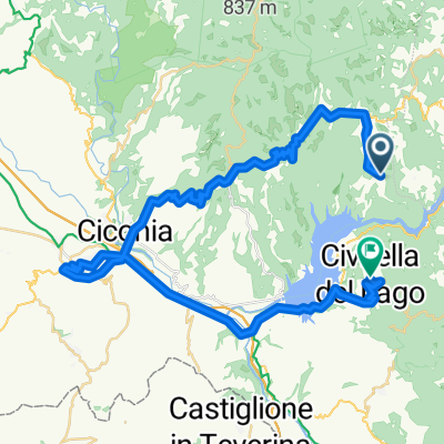 Titignano Orvieto Civitella del Lavo
- Distance
- 52.9 km
- Ascent
- 979 m
- Descent
- 1,024 m
- Location
- Todi, Umbria, Italy
 Anelli di Todi - Monte Castello di Vibio
- Distance
- 40.2 km
- Ascent
- 761 m
- Descent
- 761 m
- Location
- Todi, Umbria, Italy
 TODI 1 (ADV) - Avigliano Umbro
- Distance
- 45.9 km
- Ascent
- 892 m
- Descent
- 872 m
- Location
- Todi, Umbria, Italy
 Todi Assisi
- Distance
- 59.5 km
- Ascent
- 782 m
- Descent
- 779 m
- Location
- Todi, Umbria, Italy
 La Roccaccia
- Distance
- 10 km
- Ascent
- 484 m
- Descent
- 485 m
- Location
- Todi, Umbria, Italy
 TODI 2 (ADV+) - Avigliano Umbro
- Distance
- 56.6 km
- Ascent
- 1,008 m
- Descent
- 1,002 m
- Location
- Todi, Umbria, Italy
Open it in the app