

hankie problems
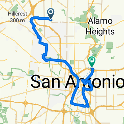
A cycling route starting in Balcones Heights, Texas, United States.
Overview
About this route
- 1 h 45 min
- Duration
- 21.2 km
- Distance
- 217 m
- Ascent
- 264 m
- Descent
- 12.1 km/h
- Avg. speed
- ---
- Max. altitude
Route photos


Continue with Bikemap
Use, edit, or download this cycling route
You would like to ride hankie problems or customize it for your own trip? Here is what you can do with this Bikemap route:
Free features
- Save this route as favorite or in collections
- Copy & plan your own version of this route
- Sync your route with Garmin or Wahoo
Premium features
Free trial for 3 days, or one-time payment. More about Bikemap Premium.
- Navigate this route on iOS & Android
- Export a GPX / KML file of this route
- Create your custom printout (try it for free)
- Download this route for offline navigation
Discover more Premium features.
Get Bikemap PremiumFrom our community
Other popular routes starting in Balcones Heights
 ANS-55km
- Distance
- 55.5 km
- Ascent
- 260 m
- Descent
- 252 m
- Location
- Balcones Heights, Texas, United States
 creek to la b
- Distance
- 20.6 km
- Ascent
- 221 m
- Descent
- 223 m
- Location
- Balcones Heights, Texas, United States
 Solo Bro
- Distance
- 15.3 km
- Ascent
- 90 m
- Descent
- 92 m
- Location
- Balcones Heights, Texas, United States
 Woodlawn Trails
- Distance
- 8.2 km
- Ascent
- 34 m
- Descent
- 30 m
- Location
- Balcones Heights, Texas, United States
 Esmeralda Drive 245, San Antonio to East Turbo Drive 118E, San Antonio
- Distance
- 20 km
- Ascent
- 145 m
- Descent
- 100 m
- Location
- Balcones Heights, Texas, United States
 Ride to Azlan
- Distance
- 10.6 km
- Ascent
- 207 m
- Descent
- 187 m
- Location
- Balcones Heights, Texas, United States
 bike tour through San Antonio
- Distance
- 27.9 km
- Ascent
- 64 m
- Descent
- 94 m
- Location
- Balcones Heights, Texas, United States
 hankie problems
- Distance
- 21.2 km
- Ascent
- 217 m
- Descent
- 264 m
- Location
- Balcones Heights, Texas, United States
Open it in the app