

Moderate ride to Roman baths
A cycling route starting in Bayt Sīrā, West Bank, Palestine.
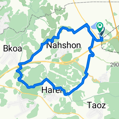
Overview
About this route
Starting from Reut center, east over the ridge, down to fields of vineyards and almond trees, to Roman ruins near Mevo Horon. We returned the same route, giving us a few long ascents, so got a good workout. The 11.6 Km is one way. Two hours riding.
- -:--
- Duration
- 11.6 km
- Distance
- 233 m
- Ascent
- 246 m
- Descent
- ---
- Avg. speed
- ---
- Max. altitude

Route quality
Waytypes & surfaces along the route
Waytypes
Track
9.9 km
(85 %)
Road
0.7 km
(6 %)
Surfaces
Paved
0.8 km
(7 %)
Unpaved
0.9 km
(8 %)
Gravel
0.9 km
(8 %)
Asphalt
0.8 km
(7 %)
Undefined
9.9 km
(85 %)
Continue with Bikemap
Use, edit, or download this cycling route
You would like to ride Moderate ride to Roman baths or customize it for your own trip? Here is what you can do with this Bikemap route:
Free features
- Save this route as favorite or in collections
- Copy & plan your own version of this route
- Sync your route with Garmin or Wahoo
Premium features
Free trial for 3 days, or one-time payment. More about Bikemap Premium.
- Navigate this route on iOS & Android
- Export a GPX / KML file of this route
- Create your custom printout (try it for free)
- Download this route for offline navigation
Discover more Premium features.
Get Bikemap PremiumFrom our community
Other popular routes starting in Bayt Sīrā
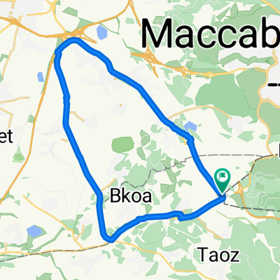
 latrun-2, 17k 120m
- Distance
- 17.2 km
- Ascent
- 184 m
- Descent
- 194 m
- Location
- Bayt Sīrā, West Bank, Palestine
 Moderate ride to Roman baths
- Distance
- 11.6 km
- Ascent
- 233 m
- Descent
- 246 m
- Location
- Bayt Sīrā, West Bank, Palestine
 ריצה:במודיעין
- Distance
- 16.3 km
- Ascent
- 365 m
- Descent
- 374 m
- Location
- Bayt Sīrā, West Bank, Palestine
 קנדה - סינגל איילון - מערבי
- Distance
- 9.7 km
- Ascent
- 366 m
- Descent
- 368 m
- Location
- Bayt Sīrā, West Bank, Palestine
 latrun
- Distance
- 30.4 km
- Ascent
- 236 m
- Descent
- 236 m
- Location
- Bayt Sīrā, West Bank, Palestine
 EPIC1902
- Distance
- 69.1 km
- Ascent
- 1,099 m
- Descent
- 1,097 m
- Location
- Bayt Sīrā, West Bank, Palestine
 סובב רעות בן שמן
- Distance
- 24.6 km
- Ascent
- 324 m
- Descent
- 322 m
- Location
- Bayt Sīrā, West Bank, Palestine
 LTR-NES
- Distance
- 94.7 km
- Ascent
- 915 m
- Descent
- 916 m
- Location
- Bayt Sīrā, West Bank, Palestine
Open it in the app