

Ors - Vermiglio
A cycling route starting in Vermiglio, Trentino-Alto Adige, Italy.
Overview
About this route
Suggestivo itinerario che si snoda su terreno vario sul versante settentrionale del torrente Vermigliana. La presenza dell'orso bruno è qui attestata sin dai tempi antichi, attratto in questi in questi ombrosi boschi dalla presenza di greggi e mandrie. Di notevole interesse il medievale castello di Ossana, la verdeggiante Valpiana e, con breve deviazione, anche i caratteristici masi di Palù.
- -:--
- Duration
- 19.1 km
- Distance
- 699 m
- Ascent
- 699 m
- Descent
- ---
- Avg. speed
- ---
- Max. altitude
Continue with Bikemap
Use, edit, or download this cycling route
You would like to ride Ors - Vermiglio or customize it for your own trip? Here is what you can do with this Bikemap route:
Free features
- Save this route as favorite or in collections
- Copy & plan your own version of this route
- Sync your route with Garmin or Wahoo
Premium features
Free trial for 3 days, or one-time payment. More about Bikemap Premium.
- Navigate this route on iOS & Android
- Export a GPX / KML file of this route
- Create your custom printout (try it for free)
- Download this route for offline navigation
Discover more Premium features.
Get Bikemap PremiumFrom our community
Other popular routes starting in Vermiglio
 Tas - Vermiglio
- Distance
- 12.1 km
- Ascent
- 250 m
- Descent
- 252 m
- Location
- Vermiglio, Trentino-Alto Adige, Italy
 GIRO DEI FORTI AUSTRIACI (CEDRON)
- Distance
- 38.2 km
- Ascent
- 1,242 m
- Descent
- 1,242 m
- Location
- Vermiglio, Trentino-Alto Adige, Italy
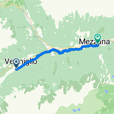 Vermiglio a Via IV Novembre, Mezzana
- Distance
- 12.2 km
- Ascent
- 69 m
- Descent
- 349 m
- Location
- Vermiglio, Trentino-Alto Adige, Italy
 Ors - Vermiglio
- Distance
- 19.1 km
- Ascent
- 699 m
- Descent
- 699 m
- Location
- Vermiglio, Trentino-Alto Adige, Italy
 fadsfasd
- Distance
- 56.1 km
- Ascent
- 668 m
- Descent
- 876 m
- Location
- Vermiglio, Trentino-Alto Adige, Italy
 Montozzo da Velon a Cogolo
- Distance
- 39.5 km
- Ascent
- 1,516 m
- Descent
- 1,668 m
- Location
- Vermiglio, Trentino-Alto Adige, Italy
 ponte di legno to riva del garda part 2
- Distance
- 113 km
- Ascent
- 1,369 m
- Descent
- 2,729 m
- Location
- Vermiglio, Trentino-Alto Adige, Italy
 Percorso per Via di Sant'Antonio, Ossana
- Distance
- 5.6 km
- Ascent
- 67 m
- Descent
- 637 m
- Location
- Vermiglio, Trentino-Alto Adige, Italy
Open it in the app