

Circuit Hiver Saint-Jeannet via Bord de Mer
A cycling route starting in Saint-Jeannet, Provence-Alpes-Côte d'Azur Region, France.
Overview
About this route
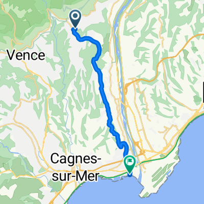
Saint-Jeannet / Vence / Tourrettes / Le Pré du Lac / Villeneuve Loubet / Cagnes / La Gaude / Saint-Jeannet > Secure circuit even in winter with this descent towards Villeneuve Loubet
- -:--
- Duration
- 60.6 km
- Distance
- 880 m
- Ascent
- 855 m
- Descent
- ---
- Avg. speed
- ---
- Max. altitude

Route quality
Waytypes & surfaces along the route
Waytypes
Quiet road
27.3 km
(45 %)
Road
8.5 km
(14 %)
Surfaces
Paved
57 km
(94 %)
Unpaved
1.2 km
(2 %)
Asphalt
57 km
(94 %)
Gravel
0.6 km
(1 %)
Continue with Bikemap
Use, edit, or download this cycling route
You would like to ride Circuit Hiver Saint-Jeannet via Bord de Mer or customize it for your own trip? Here is what you can do with this Bikemap route:
Free features
- Save this route as favorite or in collections
- Copy & plan your own version of this route
- Sync your route with Garmin or Wahoo
Premium features
Free trial for 3 days, or one-time payment. More about Bikemap Premium.
- Navigate this route on iOS & Android
- Export a GPX / KML file of this route
- Create your custom printout (try it for free)
- Download this route for offline navigation
Discover more Premium features.
Get Bikemap PremiumFrom our community
Other popular routes starting in Saint-Jeannet
 Col d'Eze, arrière pays
- Distance
- 118.7 km
- Ascent
- 1,694 m
- Descent
- 1,694 m
- Location
- Saint-Jeannet, Provence-Alpes-Côte d'Azur Region, France
 Circuit Hiver Saint-Jeannet via Bord de Mer
- Distance
- 60.6 km
- Ascent
- 880 m
- Descent
- 855 m
- Location
- Saint-Jeannet, Provence-Alpes-Côte d'Azur Region, France
 ZZZ FR Col de Vence, Col de Bleine, Col de pinpinier
- Distance
- 127.1 km
- Ascent
- 1,990 m
- Descent
- 1,988 m
- Location
- Saint-Jeannet, Provence-Alpes-Côte d'Azur Region, France
 ZZZ Paris-Nizza
- Distance
- 123.2 km
- Ascent
- 2,017 m
- Descent
- 2,024 m
- Location
- Saint-Jeannet, Provence-Alpes-Côte d'Azur Region, France
 ZZZ FR Meer/GourdonCouresegoules
- Distance
- 98.3 km
- Ascent
- 1,468 m
- Descent
- 1,464 m
- Location
- Saint-Jeannet, Provence-Alpes-Côte d'Azur Region, France
 ZZZ FR Loup und Hochebene
- Distance
- 112.7 km
- Ascent
- 1,708 m
- Descent
- 1,702 m
- Location
- Saint-Jeannet, Provence-Alpes-Côte d'Azur Region, France
 De la Gaude à la la Mer
- Distance
- 12.1 km
- Ascent
- 40 m
- Descent
- 333 m
- Location
- Saint-Jeannet, Provence-Alpes-Côte d'Azur Region, France
 ZZZ FR Gilette lezter Tag
- Distance
- 93.1 km
- Ascent
- 1,623 m
- Descent
- 1,631 m
- Location
- Saint-Jeannet, Provence-Alpes-Côte d'Azur Region, France
Open it in the app