

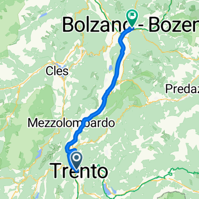
Trient - Bozen - Meran - Vinschgau - Münstertal - Zernez - Albula - Chur - Bregenz - Lindau
A cycling route starting in Trento, Trentino-Alto Adige, Italy.
Overview
About this route
TRIENT - 1 - Avisiobrücke - LAVIS - ETSCH/VIA - San Michele - ETSCH/VIA - BOZEN-Süd - ETSCH/VIA - Sigmundskron - ETSCH/VIA -Terlan - ETSCH/Radweg BZ-MERAN - Vilpian - ETSCH/ Radweg BZ-MERAN - LANA - Tscherms - VIA - Marling (- Zug bis Mals) - ETSCH/VIA - Forst - ETSCH/VIA - Naturns - ETSCH/VIA - Prad am Stilfser Joch - ETSCH/VIA - Glurns - ETSCH /VIA - Laatsch - 32 - Müstair - 32 - Valchava - VR1 - Tschierv - 27 - ZERNEZ-Schesna - VR6/Inn - La Punt (- 65 - Bhf Bever - Zug Ri. Chur) - VR6 - Albulapass - VR6 - Sils im Domleschg - Hinterrheinbrücke - VR6/ Hinterrhein - Domat/Ems - VR6/Rhein - CHUR - VR2/ Rhein - Wartau - Rheinbrücke - RHEIN - Vaduz-Rheinpark - RHEIN - Illbrücke - ÖR1/RHEIN - LUSTENAU - ÖR1/RHEIN - Hard - ÖR1 - Bregenz - BODENSEE - Lindau Hbf
- -:--
- Duration
- 408.6 km
- Distance
- 2,730 m
- Ascent
- 2,526 m
- Descent
- ---
- Avg. speed
- ---
- Max. altitude
Route quality
Waytypes & surfaces along the route
Waytypes
Track
93.6 km
(23 %)
Cycleway
86.2 km
(21 %)
Surfaces
Paved
338.5 km
(83 %)
Unpaved
55.8 km
(14 %)
Asphalt
333.8 km
(82 %)
Gravel
43.5 km
(11 %)
Route highlights
Points of interest along the route
Point of interest after 80.7 km
Bhf Marling (Vinschger Bahn)
Point of interest after 88 km
Bhf Töll (Vinschger Bahn)
Point of interest after 89.3 km
Bhf Rabland (Vinschger Bahn)
Point of interest after 92 km
Bhf Plaus (Vinschger Bahn)
Point of interest after 95.5 km
Bhf Naturns (Vinschger Bahn)
Point of interest after 105.7 km
Bhf Kastlbell (Vinschger Bahn)
Point of interest after 109.3 km
Bhf Latsch (Vinschger Bahn)
Point of interest after 113 km
Bhf Goldrain (Vinschger Bahn)
Point of interest after 118.3 km
Bhf Schlanders (Vinschger Bahn)
Point of interest after 125.6 km
Bhf Laas (Vinschger Bahn)
Accommodation after 142 km
Hotel Alte Mühle
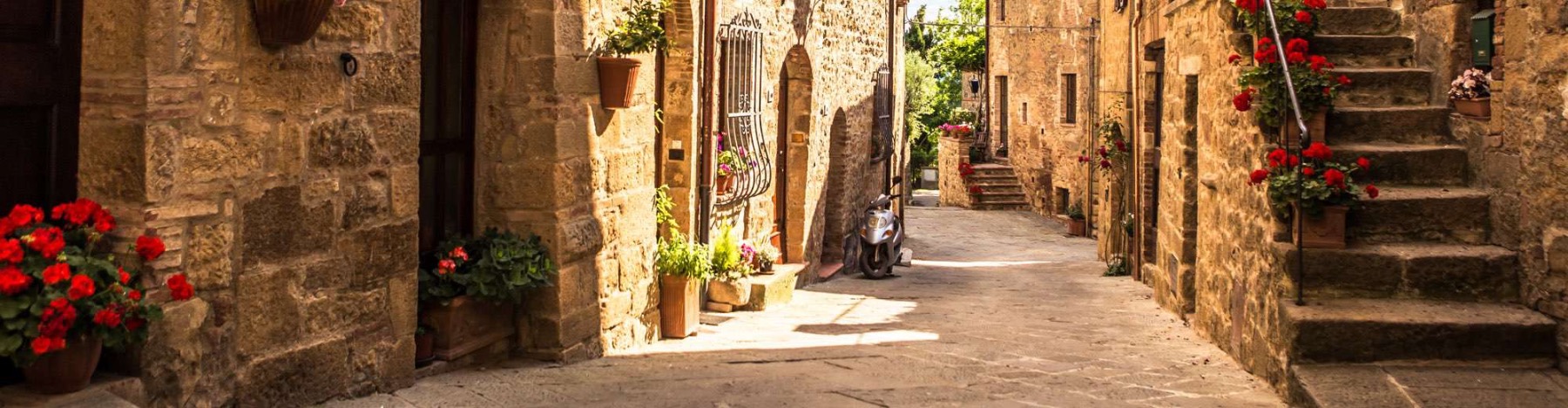
Photo after 144.3 km
Glurns
Point of interest after 145.3 km
Bhf Mals (Vinschger Bahn)
Point of interest after 223.2 km
Bhf Bever (Albulastrecke)
Photo after 230.6 km
Albulapass (2312m)
Point of interest after 237.4 km
Bhf Preda (Albulastrecke)
Point of interest after 243.8 km
Bhf Bergün (Albulastrecke)
Point of interest after 251.6 km
Bhf Filisur (Albulastrecke)
Point of interest after 254.6 km
Bhf Alvaneu (Albulastrecke)
Point of interest after 257.6 km
Bhf Surava (Albulastrecke)
Point of interest after 262.2 km
Bhf Tiefencastel (Albulastrecke)
Point of interest after 267.4 km
Bhf Solis (Albulastrecke)
Point of interest after 274.3 km
Bhf Sils im Domlegsch (Albulastrecke)
Point of interest after 275.6 km
Bhf Thusis (Albulastrecke)
Point of interest after 279.1 km
Bhf Rodels (Albulastrecke)
Point of interest after 283.6 km
Bhf Rothenbrunnen (Albulastrecke)
Point of interest after 295.2 km
Bhf Domat/Ems (Albulastrecke)
Point of interest after 298.3 km
Bhf Felsberg (Albulastrecke)
Point of interest after 303.3 km
Bhf Chur (Albulastrecke)
Continue with Bikemap
Use, edit, or download this cycling route
You would like to ride Trient - Bozen - Meran - Vinschgau - Münstertal - Zernez - Albula - Chur - Bregenz - Lindau or customize it for your own trip? Here is what you can do with this Bikemap route:
Free features
- Save this route as favorite or in collections
- Copy & plan your own version of this route
- Split it into stages to create a multi-day tour
- Sync your route with Garmin or Wahoo
Premium features
Free trial for 3 days, or one-time payment. More about Bikemap Premium.
- Navigate this route on iOS & Android
- Export a GPX / KML file of this route
- Create your custom printout (try it for free)
- Download this route for offline navigation
Discover more Premium features.
Get Bikemap PremiumFrom our community
Other popular routes starting in Trento
 Rund um den Monte Bondone
- Distance
- 87.1 km
- Ascent
- 638 m
- Descent
- 639 m
- Location
- Trento, Trentino-Alto Adige, Italy
 Pista ciclabile Trento-Bolzano CLONED FROM ROUTE 237099
- Distance
- 62.2 km
- Ascent
- 124 m
- Descent
- 49 m
- Location
- Trento, Trentino-Alto Adige, Italy
 Nauders-Gardasee3
- Distance
- 58.9 km
- Ascent
- 226 m
- Descent
- 357 m
- Location
- Trento, Trentino-Alto Adige, Italy
 Pista ciclabile dell'Adige
- Distance
- 52.7 km
- Ascent
- 68 m
- Descent
- 136 m
- Location
- Trento, Trentino-Alto Adige, Italy
 Trento - Verona
- Distance
- 119.1 km
- Ascent
- 251 m
- Descent
- 385 m
- Location
- Trento, Trentino-Alto Adige, Italy
 Trento to Feltre - (verkorte) etappe 4 tdf 2025
- Distance
- 95.1 km
- Ascent
- 1,245 m
- Descent
- 1,309 m
- Location
- Trento, Trentino-Alto Adige, Italy
 Sonntag
- Distance
- 88.4 km
- Ascent
- 331 m
- Descent
- 215 m
- Location
- Trento, Trentino-Alto Adige, Italy
 Long ride from April 13, 11:22
- Distance
- 103.5 km
- Ascent
- 88 m
- Descent
- 228 m
- Location
- Trento, Trentino-Alto Adige, Italy
Open it in the app