
J50 - Vendredi 23 février 2018 – Km 54 entre Nong Kiaw - Muang Khua – Muang Khua
Cycling route
Overview
About this route
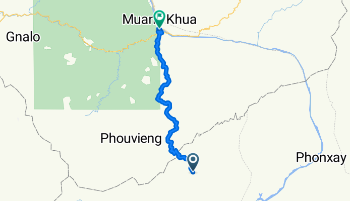
J50 - Vendredi 23 février 2018 – Km 54 entre Nong Kiaw - Muang Khua – Muang Khua
Distance parcourue : 43,24 Km - Moyenne : 7,9 Km/h
Dénivelé montant : 1352 m - Pente montante Maxi : 18 %
Dénivelé descendant : 1590 m - Pente descendante maxi : 18 %
Altitude départ : 642 m - Altitude arrivée : 404 m - Altitude Maxi : 1303 m
- -:--
- Duration
- 42.9 km
- Distance
- 1,020 m
- Ascent
- 1,294 m
- Descent
- ---
- Avg. speed
- ---
- Max. altitude
Route quality
Waytypes & surfaces along the route
Waytypes
Quiet road
42.1 km
(98 %)
Undefined
0.9 km
(2 %)
Surfaces
Paved
0.9 km
(2 %)
Asphalt
0.9 km
(2 %)
Undefined
42.1 km
(98 %)
Continue with Bikemap
Use, edit, or download this cycling route
You would like to ride J50 - Vendredi 23 février 2018 – Km 54 entre Nong Kiaw - Muang Khua – Muang Khua or customize it for your own trip? Here is what you can do with this Bikemap route:
Free features
- Save this route as favorite or in collections
- Copy & plan your own version of this route
- Sync your route with Garmin or Wahoo
Premium features
Free trial for 3 days, or one-time payment. More about Bikemap Premium.
- Navigate this route on iOS & Android
- Export a GPX / KML file of this route
- Create your custom printout (try it for free)
- Download this route for offline navigation
Discover more Premium features.
Get Bikemap PremiumOpen it in the app