

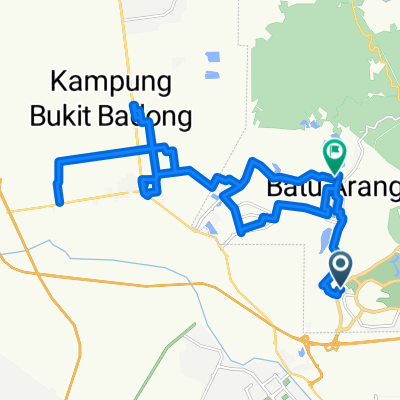
menyarip
A cycling route starting in Batu Arang, Selangor, Malaysia.
Overview
About this route
- 2 h 19 min
- Duration
- 25.9 km
- Distance
- 489 m
- Ascent
- 485 m
- Descent
- 11.2 km/h
- Avg. speed
- ---
- Max. altitude

Continue with Bikemap
Use, edit, or download this cycling route
You would like to ride menyarip or customize it for your own trip? Here is what you can do with this Bikemap route:
Free features
- Save this route as favorite or in collections
- Copy & plan your own version of this route
- Sync your route with Garmin or Wahoo
Premium features
Free trial for 3 days, or one-time payment. More about Bikemap Premium.
- Navigate this route on iOS & Android
- Export a GPX / KML file of this route
- Create your custom printout (try it for free)
- Download this route for offline navigation
Discover more Premium features.
Get Bikemap PremiumFrom our community
Other popular routes starting in Batu Arang
 100KM
100KM- Distance
- 111.7 km
- Ascent
- 609 m
- Descent
- 615 m
- Location
- Batu Arang, Selangor, Malaysia
 bandar tasik puteri ride
- Distance
- 39.7 km
- Ascent
- 240 m
- Descent
- 254 m
- Location
- Batu Arang, Selangor, Malaysia
 Jalan 7a/3 69g, Rawang to Jalan 7a/2 90, Rawang
- Distance
- 105.6 km
- Ascent
- 560 m
- Descent
- 555 m
- Location
- Batu Arang, Selangor, Malaysia
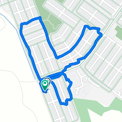
 Lorong Mahkota Impian 2/15 54, Bandar Puncak Alam to Lorong Mahkota Impian 2/15 95, Kuala Selangor
- Distance
- 7 km
- Ascent
- 71 m
- Descent
- 55 m
- Location
- Batu Arang, Selangor, Malaysia
 Jalan Pekan 1705, Batu Arang to Jalan Albert Fenelum, Batu Arang
- Distance
- 63.9 km
- Ascent
- 962 m
- Descent
- 961 m
- Location
- Batu Arang, Selangor, Malaysia
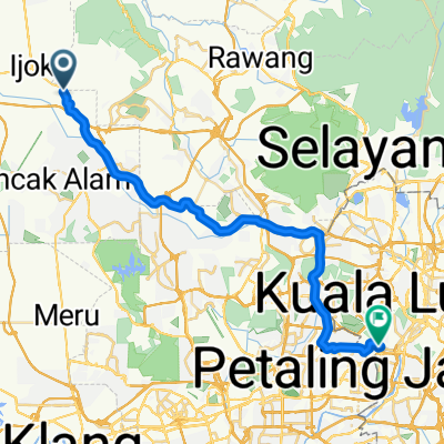 Batu Arang - Kuala Lumpur
- Distance
- 43.3 km
- Ascent
- 17 m
- Descent
- 0 m
- Location
- Batu Arang, Selangor, Malaysia
 Sekolah y - Batu Arang to Jalan Batu Arang
- Distance
- 10.1 km
- Ascent
- 122 m
- Descent
- 126 m
- Location
- Batu Arang, Selangor, Malaysia
 Lorong Gugusan Alam 7/22 60, Kuala Selangor to Lorong Gugusan Alam 7/22 60, Kuala Selangor
- Distance
- 2.1 km
- Ascent
- 22 m
- Descent
- 20 m
- Location
- Batu Arang, Selangor, Malaysia
Open it in the app