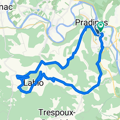
O Vers..... PUYCELCI 2019
A cycling route starting in Pradines, Languedoc-Roussillon-Midi-Pyrénées, France.
Overview
About this route
modifié depart et passage par St valery noble val
- -:--
- Duration
- 125.7 km
- Distance
- 1,646 m
- Ascent
- 1,713 m
- Descent
- ---
- Avg. speed
- ---
- Avg. speed
Continue with Bikemap
Use, edit, or download this cycling route
You would like to ride O Vers..... PUYCELCI 2019 or customize it for your own trip? Here is what you can do with this Bikemap route:
Free features
- Save this route as favorite or in collections
- Copy & plan your own version of this route
- Sync your route with Garmin or Wahoo
Premium features
Free trial for 3 days, or one-time payment. More about Bikemap Premium.
- Navigate this route on iOS & Android
- Export a GPX / KML file of this route
- Create your custom printout (try it for free)
- Download this route for offline navigation
Discover more Premium features.
Get Bikemap PremiumFrom our community
Other popular routes starting in Pradines
- Route de Mercuès, Cahors à Route de Mercuès, Cahors
- Distance
- 10.1 km
- Ascent
- 137 m
- Descent
- 140 m
- Location
- Pradines, Languedoc-Roussillon-Midi-Pyrénées, France
- Cahors Lagardelles
- Distance
- 56.2 km
- Ascent
- 512 m
- Descent
- 505 m
- Location
- Pradines, Languedoc-Roussillon-Midi-Pyrénées, France
- 44.48983043436379, 1.3508849311632578 to 44.48800854389042, 1.35826494544871
- Distance
- 0.8 km
- Ascent
- 24 m
- Descent
- 20 m
- Location
- Pradines, Languedoc-Roussillon-Midi-Pyrénées, France
- Jakobsweg-08-08-13
- Distance
- 139.1 km
- Ascent
- 700 m
- Descent
- 718 m
- Location
- Pradines, Languedoc-Roussillon-Midi-Pyrénées, France
- O Vers..... PUYCELCI 2019
- Distance
- 125.7 km
- Ascent
- 1,646 m
- Descent
- 1,713 m
- Location
- Pradines, Languedoc-Roussillon-Midi-Pyrénées, France
- DOUELLE --- CAHORS --- DOUELLE
- Distance
- 27.1 km
- Ascent
- 196 m
- Descent
- 196 m
- Location
- Pradines, Languedoc-Roussillon-Midi-Pyrénées, France
- Itinéraire reposant en Catus
- Distance
- 13.9 km
- Ascent
- 499 m
- Descent
- 486 m
- Location
- Pradines, Languedoc-Roussillon-Midi-Pyrénées, France
- 2014 Ride Day 90 - Cahors to Sarlat-la-Canéda
- Distance
- 65.2 km
- Ascent
- 646 m
- Descent
- 648 m
- Location
- Pradines, Languedoc-Roussillon-Midi-Pyrénées, France
Open it in the app