
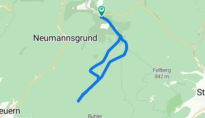
2018-02-24 LL Steinheid
A cycling route starting in Steinheid, Free State of Thuringia, Germany.
Overview
About this route
Radsport-sgs.de
- -:--
- Duration
- 10.2 km
- Distance
- 128 m
- Ascent
- 127 m
- Descent
- ---
- Avg. speed
- ---
- Max. altitude
Route quality
Waytypes & surfaces along the route
Waytypes
Track
9.7 km
(95 %)
Access road
0.3 km
(3 %)
Surfaces
Paved
0.5 km
(5 %)
Unpaved
9.7 km
(95 %)
Gravel
8 km
(79 %)
Ground
1.6 km
(16 %)
Continue with Bikemap
Use, edit, or download this cycling route
You would like to ride 2018-02-24 LL Steinheid or customize it for your own trip? Here is what you can do with this Bikemap route:
Free features
- Save this route as favorite or in collections
- Copy & plan your own version of this route
- Sync your route with Garmin or Wahoo
Premium features
Free trial for 3 days, or one-time payment. More about Bikemap Premium.
- Navigate this route on iOS & Android
- Export a GPX / KML file of this route
- Create your custom printout (try it for free)
- Download this route for offline navigation
Discover more Premium features.
Get Bikemap PremiumFrom our community
Other popular routes starting in Steinheid
 Skiwanderung Werraquelle
- Distance
- 19.1 km
- Ascent
- 259 m
- Descent
- 258 m
- Location
- Steinheid, Free State of Thuringia, Germany
 Rote Brücke - Eisfelder Ausspanne
- Distance
- 14.1 km
- Ascent
- 393 m
- Descent
- 393 m
- Location
- Steinheid, Free State of Thuringia, Germany
 KT5: 6+7_Spechtsbrunn - Brennergrün
- Distance
- 29.5 km
- Ascent
- 345 m
- Descent
- 458 m
- Location
- Steinheid, Free State of Thuringia, Germany
 Talsperre Goldisthal tangieren
- Distance
- 12.2 km
- Ascent
- 358 m
- Descent
- 358 m
- Location
- Steinheid, Free State of Thuringia, Germany
 2018-02-24 LL Steinheid
- Distance
- 10.2 km
- Ascent
- 128 m
- Descent
- 127 m
- Location
- Steinheid, Free State of Thuringia, Germany
 Runde Th. Schiefergebirge
- Distance
- 50.1 km
- Ascent
- 867 m
- Descent
- 867 m
- Location
- Steinheid, Free State of Thuringia, Germany
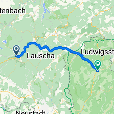
 Steinheid-Fellberg
- Distance
- 12.2 km
- Ascent
- 183 m
- Descent
- 180 m
- Location
- Steinheid, Free State of Thuringia, Germany
 Wetzhausen Saalfeld
- Distance
- 111 km
- Ascent
- 352 m
- Descent
- 849 m
- Location
- Steinheid, Free State of Thuringia, Germany
Open it in the app