

Tour B-FC 2018
Deuxième étape du tour B-FC 2018 - 92.3km 2020D+
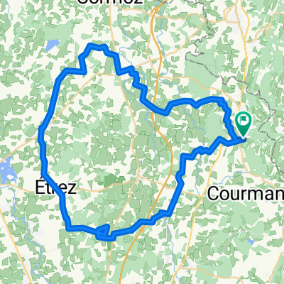
A cycling route starting in Coligny, Auvergne-Rhône-Alpes, France.
Overview
About this route
stage Auberge des Erables - La Pesse
03 84 45 05 20
- -:--
- Duration
- 92.3 km
- Distance
- 1,784 m
- Ascent
- 987 m
- Descent
- ---
- Avg. speed
- ---
- Max. altitude

Part of

Tour B-FC 2018
16 stages
Route quality
Waytypes & surfaces along the route
Waytypes
Road
56.3 km
(61 %)
Quiet road
11.1 km
(12 %)
Surfaces
Paved
30.4 km
(33 %)
Unpaved
0.9 km
(1 %)
Asphalt
30.4 km
(33 %)
Gravel
0.9 km
(1 %)
Undefined
60.9 km
(66 %)
Continue with Bikemap
Use, edit, or download this cycling route
You would like to ride Deuxième étape du tour B-FC 2018 - 92.3km 2020D+ or customize it for your own trip? Here is what you can do with this Bikemap route:
Free features
- Save this route as favorite or in collections
- Copy & plan your own version of this route
- Split it into stages to create a multi-day tour
- Sync your route with Garmin or Wahoo
Premium features
Free trial for 3 days, or one-time payment. More about Bikemap Premium.
- Navigate this route on iOS & Android
- Export a GPX / KML file of this route
- Create your custom printout (try it for free)
- Download this route for offline navigation
Discover more Premium features.
Get Bikemap PremiumFrom our community
Other popular routes starting in Coligny
 klimmen saint julien
- Distance
- 71.4 km
- Ascent
- 1,159 m
- Descent
- 1,157 m
- Location
- Coligny, Auvergne-Rhône-Alpes, France
 De 372 Rue Jean-Baptiste Jeanin, Val-d'Épy à Grand-Rue 37, Nyon
- Distance
- 124.2 km
- Ascent
- 2,328 m
- Descent
- 2,294 m
- Location
- Coligny, Auvergne-Rhône-Alpes, France
 ST JULIEN - MOIRANS
- Distance
- 43.8 km
- Ascent
- 1,005 m
- Descent
- 713 m
- Location
- Coligny, Auvergne-Rhône-Alpes, France
 Deuxième étape du tour B-FC 2018 - 92.3km 2020D+
- Distance
- 92.3 km
- Ascent
- 1,784 m
- Descent
- 987 m
- Location
- Coligny, Auvergne-Rhône-Alpes, France
 vacances 2021
- Distance
- 81.5 km
- Ascent
- 1,162 m
- Descent
- 701 m
- Location
- Coligny, Auvergne-Rhône-Alpes, France
 RC2011-Tag4-V4-Vonnas
- Distance
- 76.9 km
- Ascent
- 394 m
- Descent
- 558 m
- Location
- Coligny, Auvergne-Rhône-Alpes, France
 De Chemin Notre - Dame de la Roche à Chemin Notre - Dame de la Roche
- Distance
- 53.4 km
- Ascent
- 468 m
- Descent
- 470 m
- Location
- Coligny, Auvergne-Rhône-Alpes, France
Open it in the app