

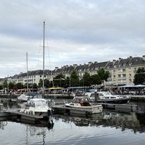
Etape 1 : Caen - Rennes
A cycling route starting in Caen, Normandy, France.
Overview
About this route
- -:--
- Duration
- 284.3 km
- Distance
- 587 m
- Ascent
- 563 m
- Descent
- ---
- Avg. speed
- ---
- Max. altitude

Route quality
Waytypes & surfaces along the route
Waytypes
Path
105.2 km
(37 %)
Road
93.8 km
(33 %)
Surfaces
Paved
105.2 km
(37 %)
Unpaved
71.1 km
(25 %)
Asphalt
102.4 km
(36 %)
Gravel
68.2 km
(24 %)
Continue with Bikemap
Use, edit, or download this cycling route
You would like to ride Etape 1 : Caen - Rennes or customize it for your own trip? Here is what you can do with this Bikemap route:
Free features
- Save this route as favorite or in collections
- Copy & plan your own version of this route
- Split it into stages to create a multi-day tour
- Sync your route with Garmin or Wahoo
Premium features
Free trial for 3 days, or one-time payment. More about Bikemap Premium.
- Navigate this route on iOS & Android
- Export a GPX / KML file of this route
- Create your custom printout (try it for free)
- Download this route for offline navigation
Discover more Premium features.
Get Bikemap PremiumFrom our community
Other popular routes starting in Caen
 Caen à D 514, Ranville
- Distance
- 14.8 km
- Ascent
- 46 m
- Descent
- 63 m
- Location
- Caen, Normandy, France
 Nomandy BikeTrip
- Distance
- 123.6 km
- Ascent
- 375 m
- Descent
- 377 m
- Location
- Caen, Normandy, France
 Caen nach Port en Bessin
- Distance
- 62.7 km
- Ascent
- 306 m
- Descent
- 357 m
- Location
- Caen, Normandy, France
 Etape 1 : Caen - Rennes
- Distance
- 284.3 km
- Ascent
- 587 m
- Descent
- 563 m
- Location
- Caen, Normandy, France
 Caen-Cabourg
- Distance
- 28.8 km
- Ascent
- 34 m
- Descent
- 45 m
- Location
- Caen, Normandy, France
 Caen Merville
- Distance
- 17.5 km
- Ascent
- 32 m
- Descent
- 35 m
- Location
- Caen, Normandy, France
 Embus'Cat
- Distance
- 23.3 km
- Ascent
- 99 m
- Descent
- 109 m
- Location
- Caen, Normandy, France
 caen mont pinson
- Distance
- 83.9 km
- Ascent
- 494 m
- Descent
- 496 m
- Location
- Caen, Normandy, France
Open it in the app