

Ammerseerunde
A cycling route starting in Weilheim, Bavaria, Germany.
Overview
About this route
- -:--
- Duration
- 101.5 km
- Distance
- 669 m
- Ascent
- 572 m
- Descent
- ---
- Avg. speed
- 684 m
- Max. altitude

Route quality
Waytypes & surfaces along the route
Waytypes
Road
36.5 km
(36 %)
Quiet road
36.5 km
(36 %)
Surfaces
Paved
87.3 km
(86 %)
Unpaved
3 km
(3 %)
Asphalt
87.3 km
(86 %)
Gravel
2 km
(2 %)
Continue with Bikemap
Use, edit, or download this cycling route
You would like to ride Ammerseerunde or customize it for your own trip? Here is what you can do with this Bikemap route:
Free features
- Save this route as favorite or in collections
- Copy & plan your own version of this route
- Split it into stages to create a multi-day tour
- Sync your route with Garmin or Wahoo
Premium features
Free trial for 3 days, or one-time payment. More about Bikemap Premium.
- Navigate this route on iOS & Android
- Export a GPX / KML file of this route
- Create your custom printout (try it for free)
- Download this route for offline navigation
Discover more Premium features.
Get Bikemap PremiumFrom our community
Other popular routes starting in Weilheim
 Weilheim-Antdorf
- Distance
- 62.3 km
- Ascent
- 754 m
- Descent
- 755 m
- Location
- Weilheim, Bavaria, Germany
 Rund ums Weilheimer Moos mit Biergärten
- Distance
- 37.6 km
- Ascent
- 156 m
- Descent
- 156 m
- Location
- Weilheim, Bavaria, Germany
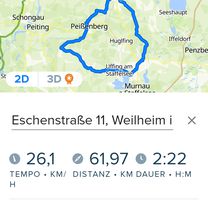
 Schwaigerstraße 7, Weilheim i.OB nach Veilchenweg 4, Weilheim i.OB
- Distance
- 36.3 km
- Ascent
- 1,183 m
- Descent
- 1,122 m
- Location
- Weilheim, Bavaria, Germany
 Ammerseerunde
- Distance
- 101.5 km
- Ascent
- 669 m
- Descent
- 572 m
- Location
- Weilheim, Bavaria, Germany
 Easy ride in Weilheim i.OB
- Distance
- 3.2 km
- Ascent
- 97 m
- Descent
- 102 m
- Location
- Weilheim, Bavaria, Germany
 RR WM - UFFING - BÖBING - WM
- Distance
- 62 km
- Ascent
- 485 m
- Descent
- 500 m
- Location
- Weilheim, Bavaria, Germany
 Trainingsroute Weilheim - Raisting
- Distance
- 21.5 km
- Ascent
- 161 m
- Descent
- 164 m
- Location
- Weilheim, Bavaria, Germany
 Morgenrunde Richtung Haarsee
- Distance
- 10.6 km
- Ascent
- 86 m
- Descent
- 87 m
- Location
- Weilheim, Bavaria, Germany
Open it in the app