

Anello Dolomiti Antonella Vial
A cycling route starting in Padua, Veneto, Italy.
Overview
About this route
The journey along the beautiful route designed and created by Antonella Vial, cycling around the mountain chain of the Dolomites, defined by 'Le Corbusier' as 'the most beautiful work of architecture in the world', has been a UNESCO World Heritage site since 2009.
We will follow the rivers Brenta, Adige, and Piave. Along the ring, we will visit Bassano del Grappa, Trento, Bolzano, Bressanone, Brunico, Dobbiaco, Cortina d'Ampezzo, Asolo, and Castelfranco, beautiful cities, authentic ancient villages. Mountains, valleys, rivers, forests, villages, a succession of wonderful landscapes where traditions and cultures are jealously guarded by their inhabitants.
- -:--
- Duration
- 566.5 km
- Distance
- 1,985 m
- Ascent
- 1,985 m
- Descent
- ---
- Avg. speed
- ---
- Max. altitude

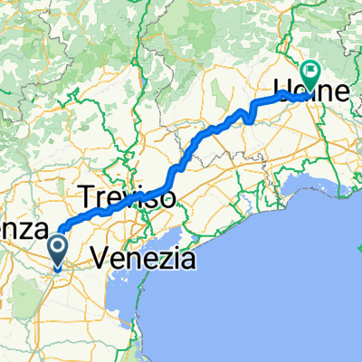
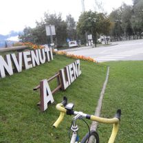
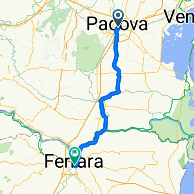
Route photos


Route quality
Waytypes & surfaces along the route
Waytypes
Cycleway
192.6 km
(34 %)
Quiet road
136 km
(24 %)
Surfaces
Paved
402.2 km
(71 %)
Unpaved
96.3 km
(17 %)
Asphalt
396.6 km
(70 %)
Gravel
45.3 km
(8 %)
Continue with Bikemap
Use, edit, or download this cycling route
You would like to ride Anello Dolomiti Antonella Vial or customize it for your own trip? Here is what you can do with this Bikemap route:
Free features
- Save this route as favorite or in collections
- Copy & plan your own version of this route
- Split it into stages to create a multi-day tour
- Sync your route with Garmin or Wahoo
Premium features
Free trial for 3 days, or one-time payment. More about Bikemap Premium.
- Navigate this route on iOS & Android
- Export a GPX / KML file of this route
- Create your custom printout (try it for free)
- Download this route for offline navigation
Discover more Premium features.
Get Bikemap PremiumFrom our community
Other popular routes starting in Padua
 Casarsa della Delizia - Guarda Veneta
- Distance
- 199.8 km
- Ascent
- 1,375 m
- Descent
- 933 m
- Location
- Padua, Veneto, Italy
 Von Padua bis Udine
- Distance
- 178.6 km
- Ascent
- 277 m
- Descent
- 190 m
- Location
- Padua, Veneto, Italy
 Padova, Treviso e terre lagunari
- Distance
- 215.2 km
- Ascent
- 36 m
- Descent
- 36 m
- Location
- Padua, Veneto, Italy
 Padova-cittadella-Bassano Tom
- Distance
- 74.4 km
- Ascent
- 204 m
- Descent
- 98 m
- Location
- Padua, Veneto, Italy
 Hungarian dream
- Distance
- 1,104.9 km
- Ascent
- 2,748 m
- Descent
- 2,660 m
- Location
- Padua, Veneto, Italy
 BDC145 GranFondo Città di Padova 2014 non ufficiale
- Distance
- 141.6 km
- Ascent
- 1,032 m
- Descent
- 1,037 m
- Location
- Padua, Veneto, Italy
 Allenamento Granfondo
- Distance
- 59 km
- Ascent
- 638 m
- Descent
- 641 m
- Location
- Padua, Veneto, Italy
 Via Antonio Locatelli to Via Salinguerra
- Distance
- 87.9 km
- Ascent
- 92 m
- Descent
- 97 m
- Location
- Padua, Veneto, Italy
Open it in the app