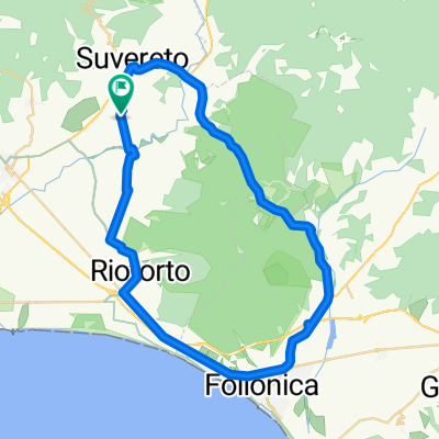
Sassetta-Monteverdi-Bolgheri 90Km / 1000Hm
- 90.3 km
- 832 m
- 841 m
- Suvereto, Tuscany, Italy
A cycling route starting in Suvereto, Tuscany, Italy.
Overview
created this 7 years ago
Route quality
Quiet road
1.8 km
(2 %)
Track
0.9 km
(1 %)
Undefined
87.6 km
(97 %)
Paved
75.9 km
(84 %)
Unpaved
0.9 km
(1 %)
Asphalt
75.9 km
(84 %)
Gravel
0.9 km
(1 %)
Undefined
13.5 km
(15 %)
Continue with Bikemap
You would like to ride Sassetta-Monteverdi-Bolgheri 90Km / 1000Hm or customize it for your own trip? Here is what you can do with this Bikemap route:
Free trial for 3 days, or one-time payment. More about Bikemap Premium.
Discover more Premium features.
Get Bikemap PremiumFrom our community
Open it in the app