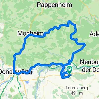
flach an Donau und Lech
A cycling route starting in Burgheim, Bavaria, Germany.
Overview
About this route
lockere GA1 Runde, überwiegend flach, nur zwischen Marxheim und Donauwörth 2 Anstiege.
- -:--
- Duration
- 83.8 km
- Distance
- 264 m
- Ascent
- 268 m
- Descent
- ---
- Avg. speed
- 453 m
- Avg. speed
Route quality
Waytypes & surfaces along the route
Waytypes
Road
28.5 km
(34 %)
Quiet road
25.3 km
(30 %)
Surfaces
Paved
75.5 km
(90 %)
Unpaved
2 km
(2 %)
Asphalt
74.6 km
(89 %)
Gravel
1.7 km
(2 %)
Continue with Bikemap
Use, edit, or download this cycling route
You would like to ride flach an Donau und Lech or customize it for your own trip? Here is what you can do with this Bikemap route:
Free features
- Save this route as favorite or in collections
- Copy & plan your own version of this route
- Sync your route with Garmin or Wahoo
Premium features
Free trial for 3 days, or one-time payment. More about Bikemap Premium.
- Navigate this route on iOS & Android
- Export a GPX / KML file of this route
- Create your custom printout (try it for free)
- Download this route for offline navigation
Discover more Premium features.
Get Bikemap PremiumFrom our community
Other popular routes starting in Burgheim
- Bahnhofstraße 38B, Burgheim nach Rathausplatz, Ingolstadt
- Distance
- 44.6 km
- Ascent
- 389 m
- Descent
- 401 m
- Location
- Burgheim, Bavaria, Germany
- Feierabendrunde CLONED FROM ROUTE 145781
- Distance
- 23.5 km
- Ascent
- 183 m
- Descent
- 183 m
- Location
- Burgheim, Bavaria, Germany
- Vatertag Tour
- Distance
- 44.2 km
- Ascent
- 244 m
- Descent
- 244 m
- Location
- Burgheim, Bavaria, Germany
- Rechts und links vom Lech - Variante Kraftwerk
- Distance
- 53.9 km
- Ascent
- 88 m
- Descent
- 89 m
- Location
- Burgheim, Bavaria, Germany
- trainingsrunde
- Distance
- 81.3 km
- Ascent
- 715 m
- Descent
- 712 m
- Location
- Burgheim, Bavaria, Germany
- Tour Hütting Nassenfels Joshofen ND/Donau Bertoldsheim Burgheim
- Distance
- 63.6 km
- Ascent
- 224 m
- Descent
- 225 m
- Location
- Burgheim, Bavaria, Germany
- Burgheim - Spindeltal
- Distance
- 42.3 km
- Ascent
- 390 m
- Descent
- 392 m
- Location
- Burgheim, Bavaria, Germany
- Drei-Landkreis-Runde
- Distance
- 62.6 km
- Ascent
- 694 m
- Descent
- 697 m
- Location
- Burgheim, Bavaria, Germany
Open it in the app