

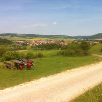
Overview
About this route
- -:--
- Duration
- 73.6 km
- Distance
- 682 m
- Ascent
- 682 m
- Descent
- ---
- Avg. speed
- ---
- Max. altitude

Part of
Deutschlandtour 2018
12 stages
Route quality
Waytypes & surfaces along the route
Waytypes
Road
27.2 km
(37 %)
Track
17.7 km
(24 %)
Surfaces
Paved
44.9 km
(61 %)
Unpaved
7.4 km
(10 %)
Asphalt
42 km
(57 %)
Gravel
3.7 km
(5 %)
Continue with Bikemap
Use, edit, or download this cycling route
You would like to ride 04. Tann - Hildburghausen or customize it for your own trip? Here is what you can do with this Bikemap route:
Free features
- Save this route as favorite or in collections
- Copy & plan your own version of this route
- Sync your route with Garmin or Wahoo
Premium features
Free trial for 3 days, or one-time payment. More about Bikemap Premium.
- Navigate this route on iOS & Android
- Export a GPX / KML file of this route
- Create your custom printout (try it for free)
- Download this route for offline navigation
Discover more Premium features.
Get Bikemap PremiumFrom our community
Other popular routes starting in Tann
 22_Dadenberg
- Distance
- 12.2 km
- Ascent
- 322 m
- Descent
- 322 m
- Location
- Tann, Hesse, Germany
 Todestour
- Distance
- 143.7 km
- Ascent
- 2,461 m
- Descent
- 2,455 m
- Location
- Tann, Hesse, Germany
 Recovered Route
- Distance
- 29.7 km
- Ascent
- 196 m
- Descent
- 192 m
- Location
- Tann, Hesse, Germany
 04. Tann - Hildburghausen
- Distance
- 73.6 km
- Ascent
- 682 m
- Descent
- 682 m
- Location
- Tann, Hesse, Germany
 In der thüringischen Rhön, auf den Spuren des 3. Reiches
- Distance
- 64.2 km
- Ascent
- 1,098 m
- Descent
- 1,096 m
- Location
- Tann, Hesse, Germany
 Tann-Gaisa-Vacha
- Distance
- 70.9 km
- Ascent
- 642 m
- Descent
- 642 m
- Location
- Tann, Hesse, Germany
 86 — Tann => Buttlar
- Distance
- 19.7 km
- Ascent
- 175 m
- Descent
- 293 m
- Location
- Tann, Hesse, Germany
 Tann - Großalmerode
- Distance
- 116.2 km
- Ascent
- 1,396 m
- Descent
- 1,420 m
- Location
- Tann, Hesse, Germany
Open it in the app